
IMAGES TAKEN NEAR TO
Richmond Road, POOLE, BH14 0BP
Introduction
This page details the photographs taken nearby to Richmond Road, BH14 0BP by members of the Geograph project.
The Geograph project started in 2005 with the aim of publishing, organising and preserving representative images for every square kilometre of Great Britain, Ireland and the Isle of Man.

There are currently over 7.5m images from over14,400 individuals and you can help contribute to the project by visiting https://www.geograph.org.uk
Image Map
Images are licensed for reuse under creativecommons.org/licenses/by-sa/2.0
Notes
- Clicking on the map will re-center to the selected point.
- The higher the marker number, the further away the image location is from the centre of the postcode.
Image Listing (33 Images Found)
Images are licensed for reuse under creativecommons.org/licenses/by-sa/2.0
Image
Details
Distance
1
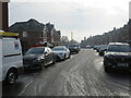
Edward Road, Upper Parkstone, Poole
Edward Road is a residential road in Upper Parkstone, a suburb of Poole.
This image was taken on a very cold December day. There had been a light dusting of snow overnight. This had turned to slush on the road surface as vehicles drove over it.
Image: © Malc McDonald
Taken: 11 Dec 2022
0.06 miles
2
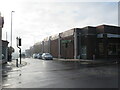
Richmond Road, Upper Parkstone, Poole
Richmond Road in Upper Parkstone, a suburb of Poole, photographed on a cold December day. There had been a dusting of snow overnight, but this had melted on the road surface, either because the road had been gritted or as a result of vehicles driving through. Pavements were still quite slippery and icy.
This photograph was taken as sunlight was clearing the mist.
Image: © Malc McDonald
Taken: 11 Dec 2022
0.06 miles
3
Churchill Road, Upper Parkstone, Poole
Churchill Road in Upper Parkstone, a suburb of Poole.
Image: © Malc McDonald
Taken: 11 Dec 2022
0.07 miles
4
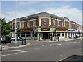
Parkstone, The Parkstone
Pub at the junction of Ashley and Churchill Roads. Internally, L-shaped bar, drinking & eating areas to the front & left. Cask ale on offer at my visit: Morland's Old Speckled Hen. Previously The Hogshead; for some customer reviews, see http://www.beerintheevening.com/pubs/s/28/2872/Hogshead/Parkstone
Image: © Mike Faherty
Taken: 9 Jul 2009
0.07 miles
5
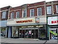
Woolworths, Branksome
Now having been closed for a couple of months the frontage of the shop is beginning to suffer from vandalism. The shop has no new takers and leaves a big gap in the shops on the north side of Ashley Rd close to the junction with Mansfield Rd and Victoria Rd
Image: © Nigel Mykura
Taken: 12 May 2009
0.07 miles
6
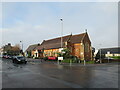
St. John's Church, Upper Parkstone, Poole
St. John's Church in Upper Parkstone, a suburb of Poole. The church does not have a spire or a tower.
Image: © Malc McDonald
Taken: 11 Dec 2022
0.07 miles
7
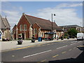
Parkstone, St. John's Church
The parish church of Heatherlands, on Ashley Road. The original church was the building to the left, now the church hall; current church built 1903.
Image: © Mike Faherty
Taken: 9 Jul 2009
0.08 miles
8
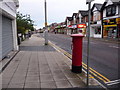
Parkstone: postbox № BH14 49, Ashley Road
This Elizabeth II-reign postbox is emptied finally at 5:30pm on weekdays and at 11:30am on Saturdays.
The fact that lights are beginning to come on says more about the weather than about the time of day. A warm sunny daytime quickly became a grey, drizzly early evening and it was unseasonally dark by just after 8pm; this picture was taken at about 8:30.
Image: © Chris Downer
Taken: 3 Aug 2009
0.09 miles
9
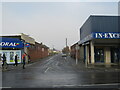
Jubilee Road, Upper Parkstone, Poole
Jubilee Road is a residential road in Upper Parkstone, a suburb of Poole.
This image was taken on a very cold December day. There had been a light dusting of snow overnight. This was now melting and turning into slush.
Image: © Malc McDonald
Taken: 11 Dec 2022
0.09 miles
10
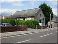
Parkstone Gospel Hall
Tiny hall in Churchill Road, next to Image
Image: © Mike Faherty
Taken: 9 Jul 2009
0.09 miles