IMAGES TAKEN NEAR TO
Dene Hill, BRADFORD, BD9 6AT
Introduction
This page details the photographs taken nearby to Dene Hill, BD9 6AT by members of the Geograph project.
The Geograph project started in 2005 with the aim of publishing, organising and preserving representative images for every square kilometre of Great Britain, Ireland and the Isle of Man.

There are currently over 7.5m images from over14,400 individuals and you can help contribute to the project by visiting https://www.geograph.org.uk
Image Map (Loading...)


Getting Data...Please wait
Leaflet Map data © OpenStreetMap
Images are licensed for reuse under creativecommons.org/licenses/by-sa/2.0
Notes
- Clicking on the map will re-center to the selected point.
- The higher the marker number, the further away the image location is from the centre of the postcode.
Image Listing (65 Images Found)
Images are licensed for reuse under creativecommons.org/licenses/by-sa/2.0
Image
Details
Distance
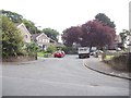
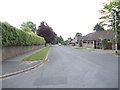
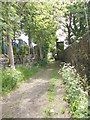
1
Chellow Lane - viewed from Denehill Road
Image: © Betty Longbottom
Taken: 29 May 2012
0.04 miles
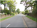
3
Chellow Lane - viewed from Denehill Road
Image: © Betty Longbottom
Taken: 29 May 2012
0.06 miles
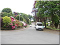
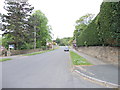
5
Malvern Brow - viewed from Malvern Road
Image: © Betty Longbottom
Taken: 29 May 2012
0.07 miles
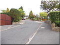
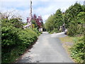
6
Malvern Road - looking towards Chellow Lane
Image: © Betty Longbottom
Taken: 29 May 2012
0.07 miles
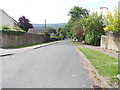
8
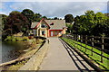
Above the Embankment, Lower Chellow Dene Reservoir
Lower of two Victorian reservoirs in a deep wooded valley within the city precincts of Bradford
Image: © Chris Heaton
Taken: 1 Sep 2014
0.09 miles