IMAGES TAKEN NEAR TO
Whitefield Place, BRADFORD, BD8 9JB
Introduction
This page details the photographs taken nearby to Whitefield Place, BD8 9JB by members of the Geograph project.
The Geograph project started in 2005 with the aim of publishing, organising and preserving representative images for every square kilometre of Great Britain, Ireland and the Isle of Man.

There are currently over 7.5m images from over14,400 individuals and you can help contribute to the project by visiting https://www.geograph.org.uk
Image Map
Images are licensed for reuse under creativecommons.org/licenses/by-sa/2.0
Notes
- Clicking on the map will re-center to the selected point.
- The higher the marker number, the further away the image location is from the centre of the postcode.
Image Listing (178 Images Found)
Images are licensed for reuse under creativecommons.org/licenses/by-sa/2.0
Image
Details
Distance
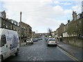
1
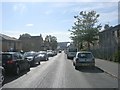
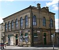
Whetley Lane WMC - Whitefield Place
Image: © Betty Longbottom
Taken: 22 Mar 2008
0.02 miles
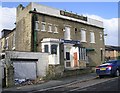
4
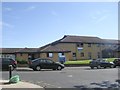
Kensington Street Health Centre - Kensington Street
Image: © Betty Longbottom
Taken: 27 Sep 2011
0.05 miles
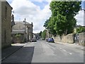
7

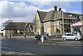
Kensington Hall, Kensington Street
A C19 former church, and more recently a social club & dance studio, being converted to a shop with 8 flats above.
Image: © Stephen Armstrong
Taken: 1 Apr 2018
0.05 miles
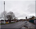
9
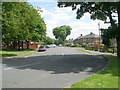
The Windsor Ballroom - Willow Street
Also known as Kensington Hall.
Image: © Betty Longbottom
Taken: 18 Apr 2007
0.05 miles