IMAGES TAKEN NEAR TO
Jarratt Street, BRADFORD, BD8 9EA
Introduction
This page details the photographs taken nearby to Jarratt Street, BD8 9EA by members of the Geograph project.
The Geograph project started in 2005 with the aim of publishing, organising and preserving representative images for every square kilometre of Great Britain, Ireland and the Isle of Man.

There are currently over 7.5m images from over14,400 individuals and you can help contribute to the project by visiting https://www.geograph.org.uk
Image Map
Images are licensed for reuse under creativecommons.org/licenses/by-sa/2.0
Notes
- Clicking on the map will re-center to the selected point.
- The higher the marker number, the further away the image location is from the centre of the postcode.
Image Listing (160 Images Found)
Images are licensed for reuse under creativecommons.org/licenses/by-sa/2.0
Image
Details
Distance
2
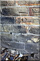
Benchmark on #85 Whetley Lane (Naples Street face)
Ordnance Survey cut mark benchmark described on the Bench Mark Database at www.bench-marks.org.uk/bm86855
Image: © Roger Templeman
Taken: 20 Jul 2017
0.03 miles
3
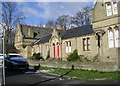
Almshouses - Macturk Grove, Whetley Lane
These were built by Elizabeth Rand, in 1876, in memory of her late husband, John, who died 27 June 1873.
Image: © Betty Longbottom
Taken: 22 Mar 2008
0.03 miles
4
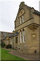
Rand's Almshouses
There is an Ordnance Survey benchmark Image on the front of the nearest apartment left of the junction with the angled wall with a carved shield
Image: © Roger Templeman
Taken: 20 Jul 2017
0.03 miles
6
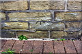
Benchmark on #2 Rand's Almshouses
Ordnance Survey cut mark benchmark described on the Bench Mark Database at www.bench-marks.org.uk/bm86854
Image: © Roger Templeman
Taken: 20 Jul 2017
0.04 miles
7
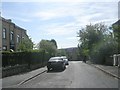
Whetley Grove - looking towards Whetley Lane
Image: © Betty Longbottom
Taken: 27 Sep 2011
0.05 miles
8
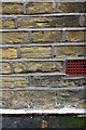
Benchmark on #17 Whetley Grove
Ordnance Survey cut mark benchmark described on the Bench Mark Database at www.bench-marks.org.uk/bm87000
Image: © Roger Templeman
Taken: 20 Jul 2017
0.06 miles
9
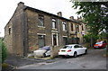
Houses on Whetley Grove
There is an Ordnance Survey benchmark Image on the side of the nearest house, left of the black downpipe
Image: © Roger Templeman
Taken: 20 Jul 2017
0.06 miles