IMAGES TAKEN NEAR TO
Horton Grange Road, BRADFORD, BD7 3AQ
Introduction
This page details the photographs taken nearby to Horton Grange Road, BD7 3AQ by members of the Geograph project.
The Geograph project started in 2005 with the aim of publishing, organising and preserving representative images for every square kilometre of Great Britain, Ireland and the Isle of Man.

There are currently over 7.5m images from over14,400 individuals and you can help contribute to the project by visiting https://www.geograph.org.uk
Image Map
Images are licensed for reuse under creativecommons.org/licenses/by-sa/2.0
Notes
- Clicking on the map will re-center to the selected point.
- The higher the marker number, the further away the image location is from the centre of the postcode.
Image Listing (102 Images Found)
Images are licensed for reuse under creativecommons.org/licenses/by-sa/2.0
Image
Details
Distance
3
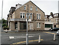
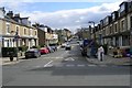
Woodhead Road at its junction with Horton Grange Road, Bradford
The empty premises were, most recently, Prashad's restaurant.
Image: © habiloid
Taken: 2 Aug 2014
0.04 miles
4
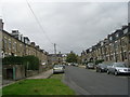
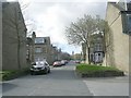
St Margaret's Road - Woodhead Road
Image: © Betty Longbottom
Taken: 23 Mar 2008
0.05 miles
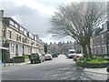
5
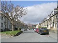
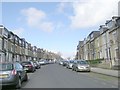
Stratford Road - Horton Grange Road
Image: © Betty Longbottom
Taken: 4 Apr 2009
0.05 miles
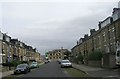
9
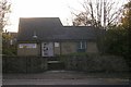
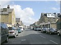
Grange Medical Centre - Horton Grange Road
Image: © Betty Longbottom
Taken: 3 Nov 2007
0.07 miles