IMAGES TAKEN NEAR TO
Dirkhill Road, BRADFORD, BD7 1QR
Introduction
This page details the photographs taken nearby to Dirkhill Road, BD7 1QR by members of the Geograph project.
The Geograph project started in 2005 with the aim of publishing, organising and preserving representative images for every square kilometre of Great Britain, Ireland and the Isle of Man.

There are currently over 7.5m images from over14,400 individuals and you can help contribute to the project by visiting https://www.geograph.org.uk
Image Map
Images are licensed for reuse under creativecommons.org/licenses/by-sa/2.0
Notes
- Clicking on the map will re-center to the selected point.
- The higher the marker number, the further away the image location is from the centre of the postcode.
Image Listing (120 Images Found)
Images are licensed for reuse under creativecommons.org/licenses/by-sa/2.0
Image
Details
Distance
3
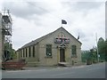
Hussania Islamic Mission - All Saints Road
Image: © Betty Longbottom
Taken: 13 Jul 2011
0.04 miles
4
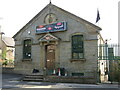
Hussania Islamic Mission, All Saints Road, Bradford
Image: © Stephen Armstrong
Taken: 6 Jul 2015
0.05 miles
5
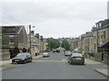
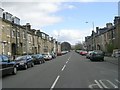
Grantham Road - viewed from Rand Place
Image: © Betty Longbottom
Taken: 13 Jul 2011
0.07 miles
7
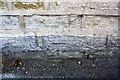
Benchmark on #10 All Saints Road (Ali Mazhar Accountants)
Ordnance Survey cut mark benchmark described on the Bench Mark Database at www.bench-marks.org.uk/bm24508
Image: © Roger Templeman
Taken: 26 Jun 2017
0.07 miles
8
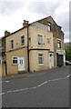
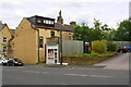
#10 All Saints Road and #1 Dirkhill Street
There is an Ordnance Survey benchmark Image on the base of the building wall to the left of the right hand white door
Image: © Roger Templeman
Taken: 26 Jun 2017
0.07 miles
9
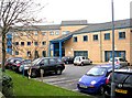
Horton Park NHS Centre - Horton Park Avenue
Image: © Betty Longbottom
Taken: 19 Dec 2007
0.08 miles
10
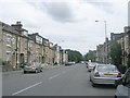
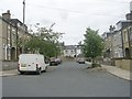
Primrose Hill houses, taxi booth and entrance to Anam's Restaurant
Ordnance Survey documents indicate that in 1956 a benchmark levelled at 149.450m above Newlyn Datum was verified on #209 Great Horton Road which was to the right of the taxi booth. The site of that building is now the entrance to Anam's carpark, with the restaurant being #211 on the site of Columbus Works.
Image: © Roger Templeman
Taken: 26 Jun 2017
0.09 miles