
IMAGES TAKEN NEAR TO
Longside Lane, BRADFORD, BD7 1DF
Introduction
This page details the photographs taken nearby to Longside Lane, BD7 1DF by members of the Geograph project.
The Geograph project started in 2005 with the aim of publishing, organising and preserving representative images for every square kilometre of Great Britain, Ireland and the Isle of Man.

There are currently over 7.5m images from over14,400 individuals and you can help contribute to the project by visiting https://www.geograph.org.uk
Image Map
Images are licensed for reuse under creativecommons.org/licenses/by-sa/2.0
Notes
- Clicking on the map will re-center to the selected point.
- The higher the marker number, the further away the image location is from the centre of the postcode.
Image Listing (240 Images Found)
Images are licensed for reuse under creativecommons.org/licenses/by-sa/2.0
Image
Details
Distance
1
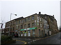
Biscayne House, Longside Lane/Smith Street, Bradford
"BISCAYNEXPRESS" convenience store with student apartments above. Located across the road from "The Green", a large, purpose built, student accommodation complex close to Bradford University.
Image: © Stephen Armstrong
Taken: 20 Jan 2018
0.01 miles
2
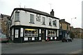
The Black Swan, Thornton Road, Bradford
Image: © Humphrey Bolton
Taken: 18 Nov 2011
0.01 miles
3
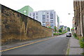
Longside Lane approaching Smith Street junction
There is an Ordnance Survey benchmark Image on the wall (which was Star Mill) above a blue drinks can near the left hand edge of the image
Image: © Roger Templeman
Taken: 17 Jun 2017
0.01 miles
4
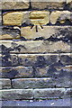
Benchmark on wall on SE side of Longside Lane
Ordnance Survey cut mark benchmark described on the Bench Mark Database at www.bench-marks.org.uk/bm85762
Image: © Roger Templeman
Taken: 17 Jun 2017
0.02 miles
5
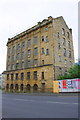
Former works building on south side of Listerhills Road
There is an Ordnance Survey benchmark Image on the front of the building at its right hand corner, left of a wooden panel
Old-Maps, eg 1:1250 1970-1978 show a building at this location as being an Oil and Soap Works. It is likely that this is the Stephenson Group Ltd (formed in 1856) building used for manufacturing soap-based agents for the processing of wool, and furniture wax and polish products.
Image: © Roger Templeman
Taken: 17 Jun 2017
0.03 miles
7

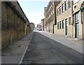
Bradford Industrial Buildings (No.5)
Stephenson's Building viewed from Hey Street. A view of the northeast gable end elevation with the stair tower behind it.
Image: © Bobby Clegg
Taken: 8 Mar 2025
0.04 miles
8
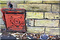
Benchmark and coal hole cover on wall of demolished #18 Listerhills Road
Ordnance Survey cut mark benchmark described on the Bench Mark Database at www.bench-marks.org.uk/bm85763
Image: © Roger Templeman
Taken: 17 Jun 2017
0.04 miles
9

Bradford Industrial Buildings (No.3)
Date stone and some cornice detail. Situated above an entrance to a former warehouse on Hey Street in the Listerhills area. I can't find any information on what the FF means.
Image: © Bobby Clegg
Taken: 8 Mar 2025
0.04 miles
10
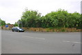
Site of #18 Listerhills Road motor body works
There is an Ordnance Survey benchmark Image on the wall (all that remains of the former works building) right of the red coal hole cover
Image: © Roger Templeman
Taken: 17 Jun 2017
0.04 miles