
IMAGES TAKEN NEAR TO
Laisteridge Lane, BRADFORD, BD5 0PS
Introduction
This page details the photographs taken nearby to Laisteridge Lane, BD5 0PS by members of the Geograph project.
The Geograph project started in 2005 with the aim of publishing, organising and preserving representative images for every square kilometre of Great Britain, Ireland and the Isle of Man.

There are currently over 7.5m images from over14,400 individuals and you can help contribute to the project by visiting https://www.geograph.org.uk
Image Map
Images are licensed for reuse under creativecommons.org/licenses/by-sa/2.0
Notes
- Clicking on the map will re-center to the selected point.
- The higher the marker number, the further away the image location is from the centre of the postcode.
Image Listing (128 Images Found)
Images are licensed for reuse under creativecommons.org/licenses/by-sa/2.0
Image
Details
Distance
1
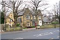
Acorn Nursing Home - Laisteridge Lane
Image: © Betty Longbottom
Taken: 19 Dec 2007
0.01 miles
2
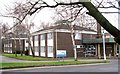
Charles Morris Hall - Laisteridge Lane
Image: © Betty Longbottom
Taken: 19 Dec 2007
0.02 miles
3
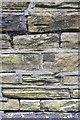
Benchmark on wall of All Saints Road in front of All Saints' Vicarage
Ordnance Survey cut mark benchmark described on the Bench Mark Database at www.bench-marks.org.uk/bm86340
Image: © Roger Templeman
Taken: 26 Jun 2017
0.03 miles
4
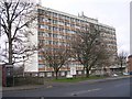
Dennis Bellamy Hall - Laisteridge Lane
Image: © Betty Longbottom
Taken: 19 Dec 2007
0.04 miles
5
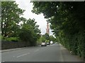
All Saints Road - off Laisteridge Lane
Image: © Betty Longbottom
Taken: 13 Jul 2011
0.04 miles
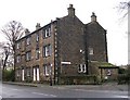
7
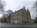
49 to 54 Little Horton Green, Bradford
Three storey back to back houses. 49 to 51 at the back, 52 to 54 at the front. Grade II Listed circa 1800 to 1830. At least one front/rear pair has been knocked through to make one house.
Image: © Stephen Armstrong
Taken: 1 Jan 2018
0.04 miles
8
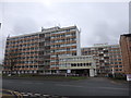
Dennis Bellamy Hall, Laisteridge Lane
Part of the Bradford University Laisteridge Lane Student Village.
Image: © Stephen Armstrong
Taken: 1 Jan 2018
0.04 miles
9
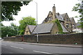
All Saints' Vicarage, All Saints Road
There is an Ordnance Survey benchmark Image on the wall above a blue notebook near the right hand edge of the image
Image: © Roger Templeman
Taken: 26 Jun 2017
0.04 miles
10
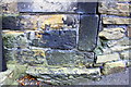
Benchmark on #52 Little Horton Green
Ordnance Survey cut mark benchmark described on the Bench Mark Database at www.bench-marks.org.uk/bm85872
Image: © Roger Templeman
Taken: 26 Jun 2017
0.04 miles