IMAGES TAKEN NEAR TO
SETTLE, BD24 9JZ
Introduction
This page details the photographs taken nearby to BD24 9JZ by members of the Geograph project.
The Geograph project started in 2005 with the aim of publishing, organising and preserving representative images for every square kilometre of Great Britain, Ireland and the Isle of Man.

There are currently over 7.5m images from over14,400 individuals and you can help contribute to the project by visiting https://www.geograph.org.uk
Image Map (Loading...)


Getting Data...Please wait
Leaflet Map data © OpenStreetMap
Images are licensed for reuse under creativecommons.org/licenses/by-sa/2.0
Notes
- Clicking on the map will re-center to the selected point.
- The higher the marker number, the further away the image location is from the centre of the postcode.
Image Listing (85 Images Found)
Images are licensed for reuse under creativecommons.org/licenses/by-sa/2.0
Image
Details
Distance
2
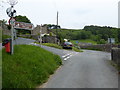
Settle Barn pumping station, Mitchell Lane
In front of the disused covered reservoir.
Image: © Christine Johnstone
Taken: 18 Feb 2024
0.04 miles
4
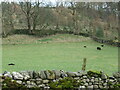
Black sheep and lambs, Upper Settle
I was not expecting to see lambs as early as 18th February.
Image: © Christine Johnstone
Taken: 18 Feb 2024
0.06 miles
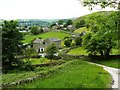
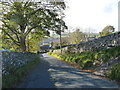
5
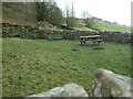
Former pinfold, Upper Settle
On Mitchell Lane. Now a picnic site. Shown on the large-scale OS map surveyed in 1847, here it is described as a pound [for impounded stray animals].
Image: © Christine Johnstone
Taken: 18 Feb 2024
0.06 miles
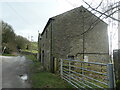
7
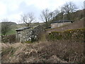
Boarded-up water treatment works, Upper Settle
Still owned by Yorkshire Water. The nearby reservoir was built by Settle Rural District Council in 1906. It was decommissioned in the 1990s and drained in 2009. The purpose of the ruined building in the foreground is unknown.
Image: © Christine Johnstone
Taken: 18 Feb 2024
0.07 miles
8
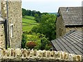
The final descent into Settle
Only a single arrow on High Hill Lane here [just 1 in 7 to 1 in 5 - 14% to 20%].
Image: © Christine Johnstone
Taken: 2 Nov 2018
0.07 miles
9
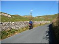
Cyclist on a steep gradient, High Hill Lane
With an even steeper gradient just around the corner.
Image: © Christine Johnstone
Taken: 2 Nov 2018
0.07 miles