IMAGES TAKEN NEAR TO
Station Road, SETTLE, BD24 9AB
Introduction
This page details the photographs taken nearby to Station Road, BD24 9AB by members of the Geograph project.
The Geograph project started in 2005 with the aim of publishing, organising and preserving representative images for every square kilometre of Great Britain, Ireland and the Isle of Man.

There are currently over 7.5m images from over14,400 individuals and you can help contribute to the project by visiting https://www.geograph.org.uk
Image Map (Loading...)


Getting Data...Please wait
Leaflet Map data © OpenStreetMap
Images are licensed for reuse under creativecommons.org/licenses/by-sa/2.0
Notes
- Clicking on the map will re-center to the selected point.
- The higher the marker number, the further away the image location is from the centre of the postcode.
Image Listing (247 Images Found)
Images are licensed for reuse under creativecommons.org/licenses/by-sa/2.0
Image
Details
Distance
2
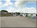
Settle Coal Company
Coal merchants would once have been a common sight in towns and cities, but are now mainly found in rural areas where coal fires are still permitted.
Image: © Stephen Craven
Taken: 19 Jul 2020
0.01 miles
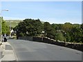
4
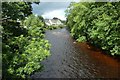
River Ribble from Penny Bridge
Looking upstream along the River Ribble in Settle.
Image: © DS Pugh
Taken: 6 Jul 2020
0.02 miles
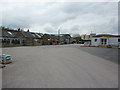
5
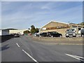
Sowarth Field, Settle
A road lined with light industry and business
Image: © David Smith
Taken: 3 Oct 2016
0.03 miles
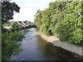
6
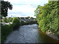
The River Ribble, Settle
Looking north west from Penny Bridge.
Image: © JThomas
Taken: 1 Oct 2016
0.03 miles
7
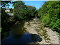
River Ribble from Penny Bridge, Settle
After a prolongued dry spell.
Image: © John H Darch
Taken: 2 May 2011
0.04 miles
8
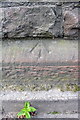
Benchmark on Penny Bridge
Ordnance Survey rivet benchmark described on the Bench Mark Database at http://www.bench-marks.org.uk/bm24416
Image: © Roger Templeman
Taken: 17 Aug 2015
0.04 miles
9
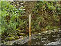
Penny Bridge FWS, Settle - depth marker
A Flood Warning Station. According to Environment Agency information, the typical river depth here is below 1 metre; 2.48m is the trigger for a flood warning; and 2.90m is the highest recorded level (at which it would be flooding onto the fields downstream of the bridge). On this summer day it was only 0.56m.
Image: © Stephen Craven
Taken: 19 Jul 2020
0.04 miles