IMAGES TAKEN NEAR TO
Park View, SKIPTON, BD23 5HA
Introduction
This page details the photographs taken nearby to Park View, BD23 5HA by members of the Geograph project.
The Geograph project started in 2005 with the aim of publishing, organising and preserving representative images for every square kilometre of Great Britain, Ireland and the Isle of Man.

There are currently over 7.5m images from over14,400 individuals and you can help contribute to the project by visiting https://www.geograph.org.uk
Image Map
Images are licensed for reuse under creativecommons.org/licenses/by-sa/2.0
Notes
- Clicking on the map will re-center to the selected point.
- The higher the marker number, the further away the image location is from the centre of the postcode.
Image Listing (85 Images Found)
Images are licensed for reuse under creativecommons.org/licenses/by-sa/2.0
Image
Details
Distance
1
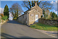
Toft House
On the 15th June 2001 the foot and mouth outbreak had spread to include animals at Toft House Farm in Threshfield.
Image: © David Rogers
Taken: 21 Nov 2008
0.01 miles
2
Threshfield Village Institute, Monkholme Lane
Image: © David Dixon
Taken: 20 Mar 2020
0.02 miles
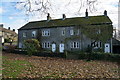
3
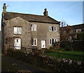
Threshfield House
This house is relatively modern by Threshfield standards with a date of 1905 above the door.
Image: © David Rogers
Taken: 21 Nov 2008
0.02 miles
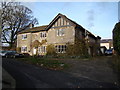
4
Houses on Main Street, Threshfield, Yorkshire
Image: © Ian S
Taken: 27 Nov 2013
0.02 miles
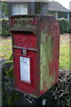
8
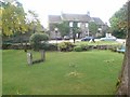
Village Green, Threshfield
Complete with a set of stocks.
Image: © Paul Buckingham
Taken: 30 Apr 2011
0.03 miles