IMAGES TAKEN NEAR TO
Wigglesworth, SKIPTON, BD23 4SB
Introduction
This page details the photographs taken nearby to BD23 4SB by members of the Geograph project.
The Geograph project started in 2005 with the aim of publishing, organising and preserving representative images for every square kilometre of Great Britain, Ireland and the Isle of Man.

There are currently over 7.5m images from over14,400 individuals and you can help contribute to the project by visiting https://www.geograph.org.uk
Image Map
Images are licensed for reuse under creativecommons.org/licenses/by-sa/2.0
Notes
- Clicking on the map will re-center to the selected point.
- The higher the marker number, the further away the image location is from the centre of the postcode.
Image Listing (10 Images Found)
Images are licensed for reuse under creativecommons.org/licenses/by-sa/2.0
Image
Details
Distance
1
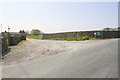
Entrance to Lower Pyethorns Farm from B6478
Ordnance Survey documents indicate that in 1960 there was a cut mark benchmark levelled at 209.296m above Newlyn Datum on a gatepost at the entrance. I suspect the walls at the entrance have been reconfigured since then
Image: © Roger Templeman
Taken: 20 Apr 2019
0.02 miles
2
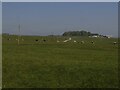
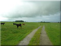
Cattle near Pyethorns
The farm in the background, in the next grid square, is called Hile.
Image: © Stephen Craven
Taken: 31 May 2021
0.12 miles
3
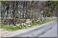
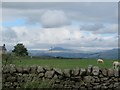
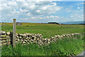
Rotten Edge Plantation on north side of B6478
There is an Ordnance Survey benchmark Image on a stone by the dry stone wall
Image: © Roger Templeman
Taken: 20 Apr 2019
0.14 miles
4
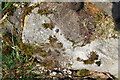
Benchmark on stone on north side B6478 at edge Rotten Edge Plantation
Ordnance Survey rivet benchmark levelled at 218.739m above Newlyn Datum in 1960. As the stone has been moved the benchmark will no longer be valid.
Image: © Roger Templeman
Taken: 20 Apr 2019
0.15 miles
7
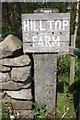
Benchmark on concrete post at entrance to Hill Top Farm
Ordnance survey cut mark benchmark levelled at 197.766m above Newlyn Datum in 1960
Image: © Roger Templeman
Taken: 20 Apr 2019
0.21 miles
8
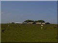
Pyethorns Farm
Viewed from the B-road to the east.
Image: © Stephen Craven
Taken: 31 May 2021
0.22 miles
9
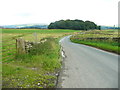
The B6478 and the start of the footpath to Tod Holes Lane
This path is blocked by a wall before Rotten Edge is reached.
Image: © Humphrey Bolton
Taken: 9 Aug 2017
0.24 miles
10
Path to Todholes Lane
The lane is ¾ of a mile away from the B6478 at Pyethorns Farm.
Image: © Mary and Angus Hogg
Taken: 15 Jun 2022
0.24 miles