IMAGES TAKEN NEAR TO
Moorber Lane, SKIPTON, BD23 4EF
Introduction
This page details the photographs taken nearby to Moorber Lane, BD23 4EF by members of the Geograph project.
The Geograph project started in 2005 with the aim of publishing, organising and preserving representative images for every square kilometre of Great Britain, Ireland and the Isle of Man.

There are currently over 7.5m images from over14,400 individuals and you can help contribute to the project by visiting https://www.geograph.org.uk
Image Map (Loading...)


Getting Data...Please wait
Leaflet Map data © OpenStreetMap
Images are licensed for reuse under creativecommons.org/licenses/by-sa/2.0
Notes
- Clicking on the map will re-center to the selected point.
- The higher the marker number, the further away the image location is from the centre of the postcode.
Image Listing (71 Images Found)
Images are licensed for reuse under creativecommons.org/licenses/by-sa/2.0
Image
Details
Distance
1
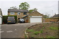
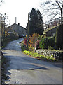
Moorber Court, Moorber Lane
Ordnance Survey documents indicate that in 1968 a benchmark levelled at 148.866m above Newlyn Datum was verified on a roadside (A65) building (probably a barn) on the right hand side of this site
Image: © Roger Templeman
Taken: 25 Apr 2019
0.01 miles
2
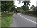
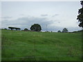
A65 near Hill Top Farm
Heading south east towards Gargrave.
Image: © JThomas
Taken: 24 Sep 2016
0.01 miles
4
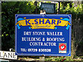
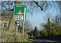
K Sharp, Dry Stone Waller
Sign at the corner of Moorber Lane and the A65 trunk road. It reminds me of a little poem I read somewhere:
I am a dry stone waller,
All day I dry stone wall,
And of life's apalling callings
Dry stone walling's worst of all.
Image: © michael ely
Taken: 12 Nov 2008
0.02 miles
7
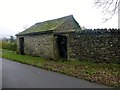
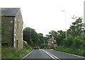
Stone Shed
Stone shed on the dead end minor road in the village of Coniston Cold towards Pot Haw Farm.
Image: © Rude Health
Taken: 9 Dec 2013
0.07 miles
9
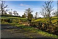
Moorber Lane
Small tributary to Rowton Beck.
Image: © Peter McDermott
Taken: 28 Dec 2020
0.11 miles
10
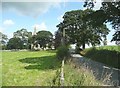
The lane to Bell Busk, Coniston Cold
The church is at the top of the rise (why is this called 'Hospital Hill'?), and then the lane drops down to Gill Syke and the River Aire at Bell Busk.
Image: © Humphrey Bolton
Taken: 8 Aug 2009
0.13 miles