IMAGES TAKEN NEAR TO
Kirkby Malham, SKIPTON, BD23 4BX
Introduction
This page details the photographs taken nearby to BD23 4BX by members of the Geograph project.
The Geograph project started in 2005 with the aim of publishing, organising and preserving representative images for every square kilometre of Great Britain, Ireland and the Isle of Man.

There are currently over 7.5m images from over14,400 individuals and you can help contribute to the project by visiting https://www.geograph.org.uk
Image Map (181 Images)


Getting Data...Please wait
Leaflet Map data © OpenStreetMap
Images are licensed for reuse under creativecommons.org/licenses/by-sa/2.0
Notes
- Clicking on the map will re-center to the selected point.
- The higher the marker number, the further away the image location is from the centre of the postcode.
Image Listing (181 Images Found)
Images are licensed for reuse under creativecommons.org/licenses/by-sa/2.0
Image
Details
Distance
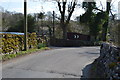
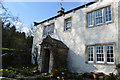
2
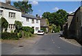
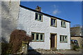
Kirkby Malham
Malham Road, seen from the bend shown in Image, again with Tarka on the left.
Image: © Derek Harper
Taken: 29 Jun 2006
0.02 miles
3
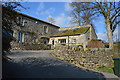
Kirkby Malham to Kirkby Brow
Kirkby Malham, where the road takes a right to Kirkby Brow and thence to Malham, North Yorkshire.
Image: © Carroll Pierce
Taken: 7 Sep 2014
0.02 miles
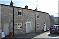
9
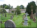
St Michael's graveyard, Kirkby Malham
Looking across the graveyard towards Main Street from near the 'Watery Grave'. See also Image
Image: © John S Turner
Taken: 7 Aug 2007
0.04 miles