IMAGES TAKEN NEAR TO
Swirecroft Road, SKIPTON, BD23 3SJ
Introduction
This page details the photographs taken nearby to Swirecroft Road, BD23 3SJ by members of the Geograph project.
The Geograph project started in 2005 with the aim of publishing, organising and preserving representative images for every square kilometre of Great Britain, Ireland and the Isle of Man.

There are currently over 7.5m images from over14,400 individuals and you can help contribute to the project by visiting https://www.geograph.org.uk
Image Map
Images are licensed for reuse under creativecommons.org/licenses/by-sa/2.0
Notes
- Clicking on the map will re-center to the selected point.
- The higher the marker number, the further away the image location is from the centre of the postcode.
Image Listing (474 Images Found)
Images are licensed for reuse under creativecommons.org/licenses/by-sa/2.0
Image
Details
Distance
1
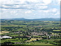
Gargrave from Sharp Haw
Almost all of the village is included in this view from the nearby hill of Sharp Haw. In the distance is Longridge Fell, which unfortunately is in Lancashire.
Image: © Gordon Hatton
Taken: 15 Jun 2008
0.03 miles
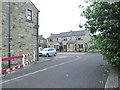
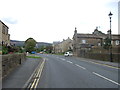
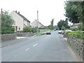
2
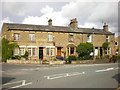
Terrace of houses on Skipton Road, Gargrave
Image: © Alexander P Kapp
Taken: 28 Aug 2009
0.03 miles
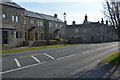
4
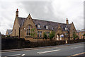
Wesleyan School, Gargrave, Yorkshire
Built in 1873
Image: © Dr Neil Clifton
Taken: 30 Jun 2008
0.04 miles
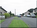
10
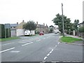
Skipton Road - viewed from Eshton Road
Image: © Betty Longbottom
Taken: 28 Aug 2013
0.06 miles