IMAGES TAKEN NEAR TO
Long Meadow, SKIPTON, BD23 1BH
Introduction
This page details the photographs taken nearby to Long Meadow, BD23 1BH by members of the Geograph project.
The Geograph project started in 2005 with the aim of publishing, organising and preserving representative images for every square kilometre of Great Britain, Ireland and the Isle of Man.

There are currently over 7.5m images from over14,400 individuals and you can help contribute to the project by visiting https://www.geograph.org.uk
Image Map
Images are licensed for reuse under creativecommons.org/licenses/by-sa/2.0
Notes
- Clicking on the map will re-center to the selected point.
- The higher the marker number, the further away the image location is from the centre of the postcode.
Image Listing (74 Images Found)
Images are licensed for reuse under creativecommons.org/licenses/by-sa/2.0
Image
Details
Distance
1
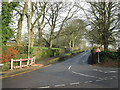
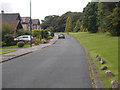
A6131, The Bailey at junction with Skipton Road
Image: © Chris Morgan
Taken: 20 May 2014
0.04 miles
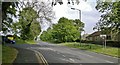
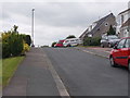
4
Greenacres - viewed from Meadow Rise
Image: © Betty Longbottom
Taken: 12 Aug 2016
0.06 miles
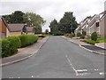
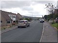
8
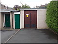
Electricity Substation No 2559 - Long Meadow
Image: © Betty Longbottom
Taken: 12 Aug 2016
0.08 miles
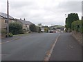
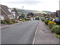
9

Tree Screen on Greenacres, Skipton
The housing estate on Greenacres is screened by a line of trees from the A6131 that runs into the centre of Skipton
Image: © Chris Heaton
Taken: 22 Nov 2020
0.09 miles