IMAGES TAKEN NEAR TO
Lower Town, KEIGHLEY, BD22 9JQ
Introduction
This page details the photographs taken nearby to Lower Town, BD22 9JQ by members of the Geograph project.
The Geograph project started in 2005 with the aim of publishing, organising and preserving representative images for every square kilometre of Great Britain, Ireland and the Isle of Man.

There are currently over 7.5m images from over14,400 individuals and you can help contribute to the project by visiting https://www.geograph.org.uk
Image Map
Images are licensed for reuse under creativecommons.org/licenses/by-sa/2.0
Notes
- Clicking on the map will re-center to the selected point.
- The higher the marker number, the further away the image location is from the centre of the postcode.
Image Listing (125 Images Found)
Images are licensed for reuse under creativecommons.org/licenses/by-sa/2.0
Image
Details
Distance
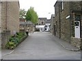
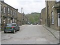
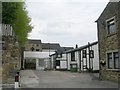
3
Oxenhope Post Office
Viewed from the junction of Lowertown and Denholme Road.
Image: © Mark Anderson
Taken: 15 Apr 2006
0.03 miles
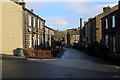
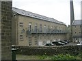
5
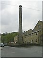
Lowertown Mill Chimney - Station Road
Image: © Betty Longbottom
Taken: 25 Apr 2009
0.03 miles
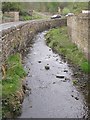
6
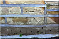
Benchmark on #2 Hill House Lane
Ordnance Survey cut mark benchmark described on the Bench Mark Database at http://bench-marks.org.uk/bm93576
Image: © Roger Templeman
Taken: 21 Feb 2018
0.03 miles
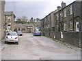
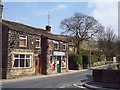
10
Oxenhope Social Club - Watson Close
Image: © Betty Longbottom
Taken: 25 Apr 2009
0.04 miles