IMAGES TAKEN NEAR TO
Plantation Fold, KEIGHLEY, BD22 7EG
Introduction
This page details the photographs taken nearby to Plantation Fold, BD22 7EG by members of the Geograph project.
The Geograph project started in 2005 with the aim of publishing, organising and preserving representative images for every square kilometre of Great Britain, Ireland and the Isle of Man.

There are currently over 7.5m images from over14,400 individuals and you can help contribute to the project by visiting https://www.geograph.org.uk
Image Map (Loading...)


Getting Data...Please wait
Leaflet Map data © OpenStreetMap
Images are licensed for reuse under creativecommons.org/licenses/by-sa/2.0
Notes
- Clicking on the map will re-center to the selected point.
- The higher the marker number, the further away the image location is from the centre of the postcode.
Image Listing (59 Images Found)
Images are licensed for reuse under creativecommons.org/licenses/by-sa/2.0
Image
Details
Distance
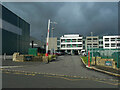
2
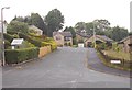
Oakbank School - viewed from Ingrow Lane
Image: © Betty Longbottom
Taken: 17 Jun 2015
0.07 miles
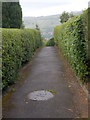
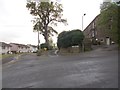
4
Oakbank Crescent - Oakbank Broadway
Image: © Betty Longbottom
Taken: 17 Jun 2015
0.09 miles
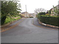
5
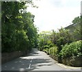
Ingrow Lane - Keighley Road, Oakworth
Image: © Betty Longbottom
Taken: 4 Jun 2008
0.09 miles
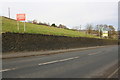
7
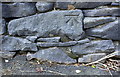
Benchmark on NW side of Keighley Road near Branshaw Park
Ordnance Survey cut mark benchmark described on the Bench Mark Database at www.bench-marks.org.uk/bm91453
Image: © Roger Templeman
Taken: 17 Nov 2017
0.10 miles
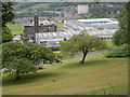
8
Beckfoot Oakbank School, Keighley
Oakbank School is a mixed secondary school and sixth form located in Keighley, West Yorkshire, England. It is situated near Ingrow Lane on Oakworth Road in the west of Keighley. It became a Sports College in 1997, and gained Technology College accreditation in 2004.
Image: © Humphrey Bolton
Taken: 22 Oct 2020
0.11 miles
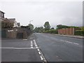
9
Keighley Road approaching Occupation Lane
There is an Ordnance Survey benchmark Image on a stone in the wall about 7m right of the construction vehicles direction sign
Image: © Roger Templeman
Taken: 17 Nov 2017
0.11 miles
10
Keighley Road - viewed from Woodview Road
Image: © Betty Longbottom
Taken: 17 Jun 2015
0.13 miles