IMAGES TAKEN NEAR TO
Staveley Grove, KEIGHLEY, BD22 7DH
Introduction
This page details the photographs taken nearby to Staveley Grove, BD22 7DH by members of the Geograph project.
The Geograph project started in 2005 with the aim of publishing, organising and preserving representative images for every square kilometre of Great Britain, Ireland and the Isle of Man.

There are currently over 7.5m images from over14,400 individuals and you can help contribute to the project by visiting https://www.geograph.org.uk
Image Map (Loading...)


Getting Data...Please wait
Leaflet Map data © OpenStreetMap
Images are licensed for reuse under creativecommons.org/licenses/by-sa/2.0
Notes
- Clicking on the map will re-center to the selected point.
- The higher the marker number, the further away the image location is from the centre of the postcode.
Image Listing (74 Images Found)
Images are licensed for reuse under creativecommons.org/licenses/by-sa/2.0
Image
Details
Distance
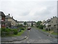
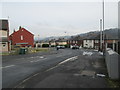
2
Staveley Road - Bracken Bank Grove
Image: © Betty Longbottom
Taken: 10 Jun 2009
0.05 miles
4
Bracken Bank Grove - viewed from Staveley Road
Image: © Betty Longbottom
Taken: 20 Jan 2015
0.07 miles
5
Staveley Road - Bracken Bank Grove
Image: © Betty Longbottom
Taken: 20 Jan 2015
0.08 miles
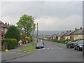
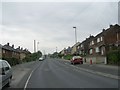
7

Bracken Bank Grove - Bracken Bank Avenue
Image: © Betty Longbottom
Taken: 10 Jun 2009
0.09 miles
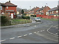
8
Bracken Bank Avenue - from Ingrow Lane
Image: © Betty Longbottom
Taken: 10 Jun 2009
0.09 miles
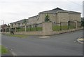
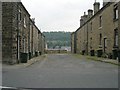
9

Nos. 4 and 6 Bracken Bank Avenue
Ordnance Survey documents indicate that in 1962 a benchmark levelled at 153.452m above Newlyn Datum was verified on the corner, right hand face, of the nearer house, behind the wooden seat
Image: © Roger Templeman
Taken: 15 May 2015
0.09 miles
10
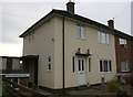
#2 Brackenbank Grove
Ordnance Survey documents indicate that in 1962 a benchmark levelled at 157.539m above Newlyn Datum was verified on the near corner, right hand face, of the house which has since been rendered
Image: © Roger Templeman
Taken: 17 Nov 2017
0.10 miles