IMAGES TAKEN NEAR TO
Staveley Road, KEIGHLEY, BD22 7BX
Introduction
This page details the photographs taken nearby to Staveley Road, BD22 7BX by members of the Geograph project.
The Geograph project started in 2005 with the aim of publishing, organising and preserving representative images for every square kilometre of Great Britain, Ireland and the Isle of Man.

There are currently over 7.5m images from over14,400 individuals and you can help contribute to the project by visiting https://www.geograph.org.uk
Image Map (Loading...)


Getting Data...Please wait
Leaflet Map data © OpenStreetMap
Images are licensed for reuse under creativecommons.org/licenses/by-sa/2.0
Notes
- Clicking on the map will re-center to the selected point.
- The higher the marker number, the further away the image location is from the centre of the postcode.
Image Listing (197 Images Found)
Images are licensed for reuse under creativecommons.org/licenses/by-sa/2.0
Image
Details
Distance
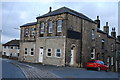
7
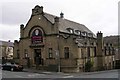
Former Chapel - Queen's Road
This is now a dance studio.
Image: © Betty Longbottom
Taken: 31 Oct 2007
0.06 miles
8

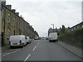
Back Aylesbury Street - Queen's Road
Image: © Betty Longbottom
Taken: 10 Jun 2009
0.06 miles
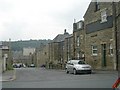
10
Keighley Industrial Co-operative Society Branch Store.
Keighley, Ingrow Lane.
Image: © Andrew Riley
Taken: 17 Mar 2013
0.06 miles