IMAGES TAKEN NEAR TO
Back Emily Street, KEIGHLEY, BD21 4AB
Introduction
This page details the photographs taken nearby to Back Emily Street, BD21 4AB by members of the Geograph project.
The Geograph project started in 2005 with the aim of publishing, organising and preserving representative images for every square kilometre of Great Britain, Ireland and the Isle of Man.

There are currently over 7.5m images from over14,400 individuals and you can help contribute to the project by visiting https://www.geograph.org.uk
Image Map (Loading...)


Getting Data...Please wait
Leaflet Map data © OpenStreetMap
Images are licensed for reuse under creativecommons.org/licenses/by-sa/2.0
Notes
- Clicking on the map will re-center to the selected point.
- The higher the marker number, the further away the image location is from the centre of the postcode.
Image Listing (457 Images Found)
Images are licensed for reuse under creativecommons.org/licenses/by-sa/2.0
Image
Details
Distance
5
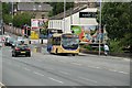
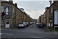
Keighley, Bradford Road
Keighley & District Bus on Service 662 Bradford - Keighley passing the former Eastwood Tavern.
Image: © Andrew Riley
Taken: 18 Jul 2015
0.04 miles
6
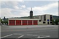
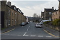
Keighley fire station
Keighley fire station, Bradford Road, Keighley, West Yorkshire.
Image: © Kevin Hale
Taken: 11 Jun 2006
0.04 miles
8

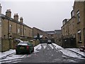
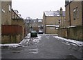
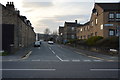
Victoria Park Street - Parson Street
Image: © Betty Longbottom
Taken: 7 Jan 2009
0.04 miles