IMAGES TAKEN NEAR TO
Upwood Lane, KEIGHLEY, BD20 5TX
Introduction
This page details the photographs taken nearby to Upwood Lane, BD20 5TX by members of the Geograph project.
The Geograph project started in 2005 with the aim of publishing, organising and preserving representative images for every square kilometre of Great Britain, Ireland and the Isle of Man.

There are currently over 7.5m images from over14,400 individuals and you can help contribute to the project by visiting https://www.geograph.org.uk
Image Map (Loading...)


Getting Data...Please wait
Leaflet Map data © OpenStreetMap
Images are licensed for reuse under creativecommons.org/licenses/by-sa/2.0
Notes
- Clicking on the map will re-center to the selected point.
- The higher the marker number, the further away the image location is from the centre of the postcode.
Image Listing (9 Images Found)
Images are licensed for reuse under creativecommons.org/licenses/by-sa/2.0
Image
Details
Distance
1
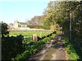
Moorlands Farm, East Morton
The main farmhouse dates from 1670 and is grade II listed (list entry 1199660).
Image: © Stephen Craven
Taken: 2 Feb 2019
0.00 miles
2
Upwood Lane (unmetalled section)
Upwood Lane is surfaced for motor traffic as far as Moorlands Farm, beyond which it is only a bridleway.
Image: © Stephen Craven
Taken: 2 Feb 2019
0.09 miles
3
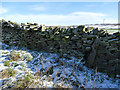
Old gatepost on Upwood Lane
There is a hinge on the left of this no-longer-upright stone, suggesting it was once used as a gatepost, but there's no corresponding post to the left of it, so maybe it's just been re-used as walling material.
Image: © Stephen Craven
Taken: 2 Feb 2019
0.11 miles
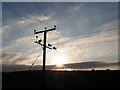
4
Field track to the south of Grass Road
A lot of hoof prints in the fresh snow, but no sign of the sheep(?) that made them.
Image: © Stephen Craven
Taken: 2 Feb 2019
0.18 miles
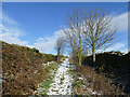
5
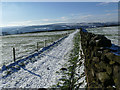
Grass Road, looking west
The bridleway runs dead straight between dry stone walls in a west-north-westerly direction for almost exactly one kilometre from here.
Image: © Stephen Craven
Taken: 2 Feb 2019
0.18 miles
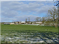
6
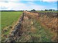
Grass Road near West Morton
Seen here heading northwest across the gridsquare, this green lane is named by the 1:25k OS map as Grass Road. Well, it isn't. Look at the fields. That's grass. The lane should be called Tropical Rain Forest With Lots Of Nasty Hurty Thistles Road.
Image: © David Spencer
Taken: 1 Sep 2005
0.19 miles
7
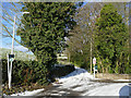
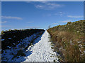
The start of Upwood Lane
The lane is a bridleway and farm access track that leads up onto the moors above Riddlesden.
Image: © Stephen Craven
Taken: 2 Feb 2019
0.20 miles