IMAGES TAKEN NEAR TO
Larkfield, KEIGHLEY, BD20 5QY
Introduction
This page details the photographs taken nearby to Larkfield, BD20 5QY by members of the Geograph project.
The Geograph project started in 2005 with the aim of publishing, organising and preserving representative images for every square kilometre of Great Britain, Ireland and the Isle of Man.

There are currently over 7.5m images from over14,400 individuals and you can help contribute to the project by visiting https://www.geograph.org.uk
Image Map
Images are licensed for reuse under creativecommons.org/licenses/by-sa/2.0
Notes
- Clicking on the map will re-center to the selected point.
- The higher the marker number, the further away the image location is from the centre of the postcode.
Image Listing (15 Images Found)
Images are licensed for reuse under creativecommons.org/licenses/by-sa/2.0
Image
Details
Distance
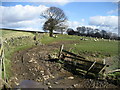
1
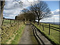
Access Lane to Larkfield Farm
Avenue type driveway that leads to Larkfield Farm, north of Riddlesden.
Image: © Chris Heaton
Taken: 4 Mar 2008
0.04 miles
2
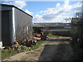
Farm Buildings at The Height
Confusion could reign in this square, for it boasts two complexes called Heights Farm - and also this one called The Height. It is a bit messy, but the two old boys that run the place seem to welcome walkers and like to pass the time of day with them.
Image: © Chris Heaton
Taken: 4 Mar 2008
0.13 miles
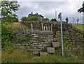
3
The Height
One of a series of farms below the southern edge of Rombalds Moor above the Aire Valley.
Image: © John Illingworth
Taken: 31 Aug 2005
0.13 miles
6
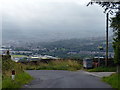
Banks Lane and the backdrop of Keighley town
On the steep northern slopes of the River Aire valley.
Image: © Mat Fascione
Taken: 13 Aug 2016
0.20 miles
8
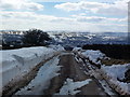
After the snow plough
Banks Lane, above Riddlesden.
Image: © John H Darch
Taken: 30 Mar 2013
0.21 miles
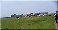
9
Pastures near The Heights
Passed while following the right of way between The Height and Heights Farm.
Image: © Chris Heaton
Taken: 4 Mar 2008
0.21 miles
10
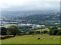
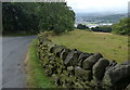
View across the town of Keighley
The view from Banks Lane at The Height, on the steep northern slopes of the River Aire valley.
Image: © Mat Fascione
Taken: 13 Aug 2016
0.22 miles