IMAGES TAKEN NEAR TO
Hospital Road, KEIGHLEY, BD20 5EP
Introduction
This page details the photographs taken nearby to Hospital Road, BD20 5EP by members of the Geograph project.
The Geograph project started in 2005 with the aim of publishing, organising and preserving representative images for every square kilometre of Great Britain, Ireland and the Isle of Man.

There are currently over 7.5m images from over14,400 individuals and you can help contribute to the project by visiting https://www.geograph.org.uk
Image Map
Images are licensed for reuse under creativecommons.org/licenses/by-sa/2.0
Notes
- Clicking on the map will re-center to the selected point.
- The higher the marker number, the further away the image location is from the centre of the postcode.
Image Listing (207 Images Found)
Images are licensed for reuse under creativecommons.org/licenses/by-sa/2.0
Image
Details
Distance
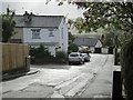
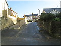
3
Hospital Road, Riddlesden
Looking eastward.
Image: © Peter Wood
Taken: 21 Jun 2016
0.06 miles
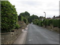
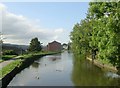
5
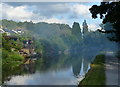
Leeds and Liverpool Canal in Riddlesden
Image: © Mat Fascione
Taken: 13 Aug 2016
0.07 miles
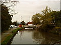
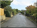
7
Leeds & Liverpool Canal - Granby Lane
Image: © Betty Longbottom
Taken: 23 Sep 2008
0.07 miles
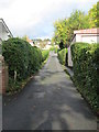
8
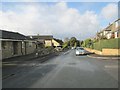
Carr Lane - viewed from Carr Grove
Image: © Betty Longbottom
Taken: 29 Oct 2013
0.08 miles
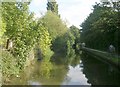
10
Leeds & Liverpool Canal - Granby Lane
Image: © Betty Longbottom
Taken: 23 Sep 2008
0.08 miles