IMAGES TAKEN NEAR TO
Thanet Garth, KEIGHLEY, BD20 0QW
Introduction
This page details the photographs taken nearby to Thanet Garth, BD20 0QW by members of the Geograph project.
The Geograph project started in 2005 with the aim of publishing, organising and preserving representative images for every square kilometre of Great Britain, Ireland and the Isle of Man.

There are currently over 7.5m images from over14,400 individuals and you can help contribute to the project by visiting https://www.geograph.org.uk
Image Map (Loading...)


Getting Data...Please wait
Leaflet Map data © OpenStreetMap
Images are licensed for reuse under creativecommons.org/licenses/by-sa/2.0
Notes
- Clicking on the map will re-center to the selected point.
- The higher the marker number, the further away the image location is from the centre of the postcode.
Image Listing (159 Images Found)
Images are licensed for reuse under creativecommons.org/licenses/by-sa/2.0
Image
Details
Distance
6
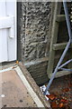
Benchmark on #7 Howden Road
Ordnance Survey cut mark benchmark described on the Bench Mark Database at http://www.bench-marks.org.uk/bm77641
Image: © Roger Templeman
Taken: 30 Jul 2016
0.06 miles
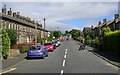
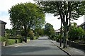
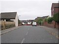
7
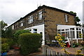
Houses on Howden Road
There is an OS benchmark Image on the corner of the nearest house at the junction of the house and its front porch extension
Image: © Roger Templeman
Taken: 30 Jul 2016
0.06 miles
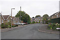
9
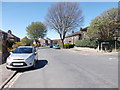
Howden Road - viewed from Jacques Grove
Image: © Betty Longbottom
Taken: 27 Apr 2015
0.07 miles