IMAGES TAKEN NEAR TO
Hightown Road, CLECKHEATON, BD19 5JP
Introduction
This page details the photographs taken nearby to Hightown Road, BD19 5JP by members of the Geograph project.
The Geograph project started in 2005 with the aim of publishing, organising and preserving representative images for every square kilometre of Great Britain, Ireland and the Isle of Man.

There are currently over 7.5m images from over14,400 individuals and you can help contribute to the project by visiting https://www.geograph.org.uk
Image Map
Images are licensed for reuse under creativecommons.org/licenses/by-sa/2.0
Notes
- Clicking on the map will re-center to the selected point.
- The higher the marker number, the further away the image location is from the centre of the postcode.
Image Listing (101 Images Found)
Images are licensed for reuse under creativecommons.org/licenses/by-sa/2.0
Image
Details
Distance
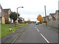
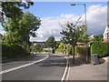
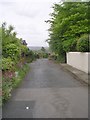
2
Hightown Road - viewed from Filey Royd
Image: © Betty Longbottom
Taken: 14 Nov 2012
0.04 miles
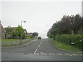
3
Hightown Road - viewed from Filey Royd
Image: © Betty Longbottom
Taken: 14 Nov 2012
0.06 miles
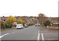
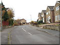
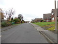
4
Hightown Road, Liversedge
This road was built in 1927 as a direct connection from Hightown to Cleckheaton.
Image: © Humphrey Bolton
Taken: 3 Sep 2007
0.06 miles
5
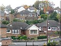
Lower Blacup
The bungalows are on Royd Wood, the houses on Hightown Road.
Image: © Christine Johnstone
Taken: 28 Oct 2010
0.06 miles
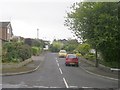
6
Filey Royd - viewed from Royd Wood
Image: © Betty Longbottom
Taken: 14 Nov 2012
0.06 miles
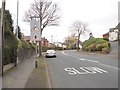
9
Quaker Lane - viewed from Ashbourne View
Image: © Betty Longbottom
Taken: 14 Nov 2012
0.07 miles