IMAGES TAKEN NEAR TO
Mazebrook, CLECKHEATON, BD19 4BT
Introduction
This page details the photographs taken nearby to Mazebrook, BD19 4BT by members of the Geograph project.
The Geograph project started in 2005 with the aim of publishing, organising and preserving representative images for every square kilometre of Great Britain, Ireland and the Isle of Man.

There are currently over 7.5m images from over14,400 individuals and you can help contribute to the project by visiting https://www.geograph.org.uk
Image Map
Images are licensed for reuse under creativecommons.org/licenses/by-sa/2.0
Notes
- Clicking on the map will re-center to the selected point.
- The higher the marker number, the further away the image location is from the centre of the postcode.
Image Listing (57 Images Found)
Images are licensed for reuse under creativecommons.org/licenses/by-sa/2.0
Image
Details
Distance
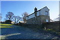
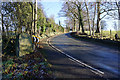
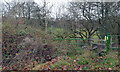
4
Spen Valley Heritage Trail descending from Mazebrook
Image: © Chris Heaton
Taken: 25 Jan 2023
0.07 miles

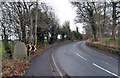
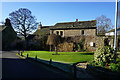
9
Spen Valley Heritage Trail at Merchant Fields
Image: © Ian S
Taken: 23 Jan 2019
0.09 miles
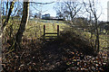
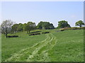
10
Path between Drub and Hunsworth leaving Drub Lane
Image: © habiloid
Taken: 22 Nov 2020
0.10 miles