IMAGES TAKEN NEAR TO
Red Vale, CLECKHEATON, BD19 4AJ
Introduction
This page details the photographs taken nearby to Red Vale, BD19 4AJ by members of the Geograph project.
The Geograph project started in 2005 with the aim of publishing, organising and preserving representative images for every square kilometre of Great Britain, Ireland and the Isle of Man.

There are currently over 7.5m images from over14,400 individuals and you can help contribute to the project by visiting https://www.geograph.org.uk
Image Map
Images are licensed for reuse under creativecommons.org/licenses/by-sa/2.0
Notes
- Clicking on the map will re-center to the selected point.
- The higher the marker number, the further away the image location is from the centre of the postcode.
Image Listing (83 Images Found)
Images are licensed for reuse under creativecommons.org/licenses/by-sa/2.0
Image
Details
Distance
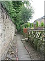
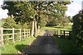
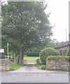
4
Public Footpath leading onto Knowles Lane
Narrow path from the A652 to Knowles Lane in the northern reaches of Gomersal
Image: © Chris Heaton
Taken: 17 Jun 2018
0.04 miles
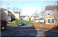
5
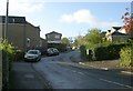
Richmond Grove - Dewsbury Road, Birkenshaw
Image: © Betty Longbottom
Taken: 31 Oct 2008
0.05 miles
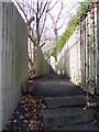
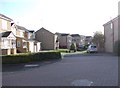
7
Footpath - Dewsbury Road, Birkenshaw
Image: © Betty Longbottom
Taken: 31 Oct 2008
0.06 miles
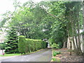
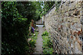
10
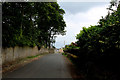
Knowles Lane
Quiet lane in the northern environs of Gomersal
Image: © Chris Heaton
Taken: 17 Jun 2018
0.08 miles