IMAGES TAKEN NEAR TO
Stunsteads Road, CLECKHEATON, BD19 3DA
Introduction
This page details the photographs taken nearby to Stunsteads Road, BD19 3DA by members of the Geograph project.
The Geograph project started in 2005 with the aim of publishing, organising and preserving representative images for every square kilometre of Great Britain, Ireland and the Isle of Man.

There are currently over 7.5m images from over14,400 individuals and you can help contribute to the project by visiting https://www.geograph.org.uk
Image Map
Images are licensed for reuse under creativecommons.org/licenses/by-sa/2.0
Notes
- Clicking on the map will re-center to the selected point.
- The higher the marker number, the further away the image location is from the centre of the postcode.
Image Listing (148 Images Found)
Images are licensed for reuse under creativecommons.org/licenses/by-sa/2.0
Image
Details
Distance
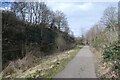
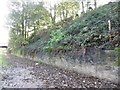
2
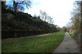
Wide cutting in Cleckheaton
Forming part of National Cycle Network Route 66, the Spen Valley Greenway runs between Bradford and Dewsbury.
Image: © DS Pugh
Taken: 25 Feb 2023
0.04 miles
3

Greenway north of Cleckheaton
The cutting once carried a four-track section of the LMSR Cleckheaton branch, but now only the Spen Valley Greenway uses the space. See also Image
Image: © Stephen Craven
Taken: 17 Jun 2017
0.04 miles
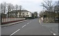
4
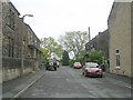
Whitechapel Road, Cleckheaton
The nearer of the semis is captioned Whitechapel Vicarage on the large-scale OS map. The side of the house shows signs of having had an extension, since removed. The semis are dated 1904 over the doors, and the detached house beyond is probably of similar date (it is shown on the 1907 OS map).
Image: © Humphrey Bolton
Taken: 3 Mar 2008
0.04 miles
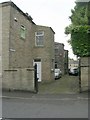
5
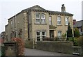
Whitcliffe House - Whitcliffe Road
Image: © Betty Longbottom
Taken: 22 Apr 2008
0.04 miles
6
Path north of Whitcliffe Road
Forming part of National Cycle Network Route 66, the Spen Valley Greenway runs between Bradford and Dewsbury.
Image: © DS Pugh
Taken: 25 Feb 2023
0.04 miles
8
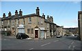
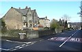
Corner shop, Scott Lane, Cleckheaton
Corner shops often have a corner door with a shaped lintel over, with a variety of decorative features. In 1850 Scott Lane was the lower end of Wickcliffe lane, as it was spelt then, and had fields each side. Old lanes like this became the basis for the suburban development of the later 19C.
Image: © Humphrey Bolton
Taken: 14 Apr 2008
0.04 miles
10
Sign of former use
Railway quarter mile post on the embankment, Spen Valley Greenway.
Image: © Christine Johnstone
Taken: 28 Oct 2010
0.05 miles