IMAGES TAKEN NEAR TO
Cote Drive, BD15 8HN
Introduction
This page details the photographs taken nearby to Cote Drive, BD15 8HN by members of the Geograph project.
The Geograph project started in 2005 with the aim of publishing, organising and preserving representative images for every square kilometre of Great Britain, Ireland and the Isle of Man.

There are currently over 7.5m images from over14,400 individuals and you can help contribute to the project by visiting https://www.geograph.org.uk
Image Map
Images are licensed for reuse under creativecommons.org/licenses/by-sa/2.0
Notes
- Clicking on the map will re-center to the selected point.
- The higher the marker number, the further away the image location is from the centre of the postcode.
Image Listing (65 Images Found)
Images are licensed for reuse under creativecommons.org/licenses/by-sa/2.0
Image
Details
Distance
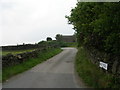
1
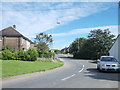
Footpath to Bailey Fold - Cote Lane
Image: © Betty Longbottom
Taken: 31 Aug 2012
0.04 miles
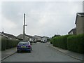
3
Ascending Bailey Fold
Steep access lane from Lower Bailey Fold Farm leading to Cote Lane
Image: © Chris Heaton
Taken: 22 Dec 2016
0.07 miles
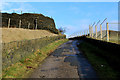
6
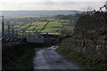
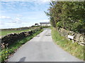
Descending Bailey Fold
Steep access lane leading down to Lower Bailey Fold Farm - with views over the valley of Pitty Beck and Thornton Village beyond, indicated by the church spire.
Image: © Chris Heaton
Taken: 22 Dec 2016
0.09 miles
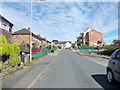
7
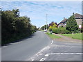
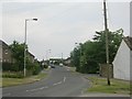
Cote Lane - viewed from Hill Top Lane
Image: © Betty Longbottom
Taken: 31 Aug 2012
0.09 miles