IMAGES TAKEN NEAR TO
Ormonde Drive, BRADFORD, BD15 7SZ
Introduction
This page details the photographs taken nearby to Ormonde Drive, BD15 7SZ by members of the Geograph project.
The Geograph project started in 2005 with the aim of publishing, organising and preserving representative images for every square kilometre of Great Britain, Ireland and the Isle of Man.

There are currently over 7.5m images from over14,400 individuals and you can help contribute to the project by visiting https://www.geograph.org.uk
Image Map
Images are licensed for reuse under creativecommons.org/licenses/by-sa/2.0
Notes
- Clicking on the map will re-center to the selected point.
- The higher the marker number, the further away the image location is from the centre of the postcode.
Image Listing (67 Images Found)
Images are licensed for reuse under creativecommons.org/licenses/by-sa/2.0
Image
Details
Distance
3
Rayner Mount - looking towards Bracewell Avenue
Image: © Betty Longbottom
Taken: 27 Oct 2012
0.03 miles
5
Electricity Substation No 957 - Rayner Mount
Image: © Betty Longbottom
Taken: 27 Oct 2012
0.04 miles
10
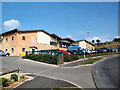
Allerton Health Centre
New health centre in Bell Dean Road, housing three GP practices. An example of NHS primary healthcare investment in an area where the general population's health is, frankly, atrocious.
Image: © David Spencer
Taken: 17 Aug 2005
0.10 miles