IMAGES TAKEN NEAR TO
Broomfield Place, BRADFORD, BD14 6PL
Introduction
This page details the photographs taken nearby to Broomfield Place, BD14 6PL by members of the Geograph project.
The Geograph project started in 2005 with the aim of publishing, organising and preserving representative images for every square kilometre of Great Britain, Ireland and the Isle of Man.

There are currently over 7.5m images from over14,400 individuals and you can help contribute to the project by visiting https://www.geograph.org.uk
Image Map
Images are licensed for reuse under creativecommons.org/licenses/by-sa/2.0
Notes
- Clicking on the map will re-center to the selected point.
- The higher the marker number, the further away the image location is from the centre of the postcode.
Image Listing (54 Images Found)
Images are licensed for reuse under creativecommons.org/licenses/by-sa/2.0
Image
Details
Distance
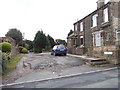
2
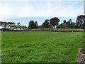
Brook Lane - viewed from Broomfield
Image: © Betty Longbottom
Taken: 22 Aug 2012
0.04 miles
3
Sealed air shaft on a disused railway tunnel, Clayton
Image: © Humphrey Bolton
Taken: 24 Jun 2010
0.04 miles
4
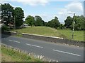
Strip of land over the Clayton railway tunnel
This looks like a disused railway on the map, and so it is but the railway was in a tunnel far below. The strip of land over it is mounded up with spoil hauled up the air shafts.
Image: © Humphrey Bolton
Taken: 24 Jun 2010
0.04 miles
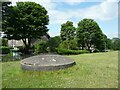
5
Former railway tunnel line, Clayton
What looks like a railway embankment is in fact the line above the Clayton tunnel, a 1000 yard tunnel on the former Bradford to Queensbury line. You can just see in the middle of the photo the cap of a ventilation shaft. The tunnel is now closed off but photos available elsewhere on the internet show that it is not infilled. See Image for the line of the tunnel the other side of the road.
Image: © Stephen Craven
Taken: 12 Oct 2019
0.05 miles
7
Brook Lane - viewed from Broomfield
Image: © Betty Longbottom
Taken: 22 Aug 2012
0.05 miles
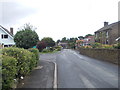
8
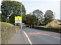
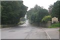
Entering Clayton on Baldwin Lane
Looking northward.
Image: © Peter Wood
Taken: 5 Oct 2014
0.06 miles
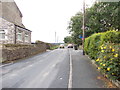
9
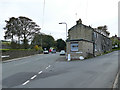
Junction of Baldwin Lane and Brook Lane
The row of cottages with the single-storey extension at this end dates from 1840 and is grade II listed (list entry 1133295).
Image: © Stephen Craven
Taken: 12 Oct 2019
0.07 miles
