IMAGES TAKEN NEAR TO
St. Pauls Avenue, BRADFORD, BD11 2JZ
Introduction
This page details the photographs taken nearby to St. Pauls Avenue, BD11 2JZ by members of the Geograph project.
The Geograph project started in 2005 with the aim of publishing, organising and preserving representative images for every square kilometre of Great Britain, Ireland and the Isle of Man.

There are currently over 7.5m images from over14,400 individuals and you can help contribute to the project by visiting https://www.geograph.org.uk
Image Map
Images are licensed for reuse under creativecommons.org/licenses/by-sa/2.0
Notes
- Clicking on the map will re-center to the selected point.
- The higher the marker number, the further away the image location is from the centre of the postcode.
Image Listing (142 Images Found)
Images are licensed for reuse under creativecommons.org/licenses/by-sa/2.0
Image
Details
Distance
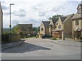
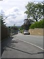
4
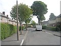
St Paul's Road - looking towards Old Lane
Image: © Betty Longbottom
Taken: 17 Aug 2011
0.03 miles
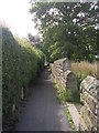
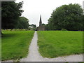
5
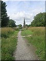
Footpath from St Paul's Road to St Paul's Church
Image: © Betty Longbottom
Taken: 17 Aug 2011
0.03 miles
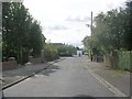
6
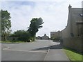
Prospect Lane - looking towards Old Lane
Image: © Betty Longbottom
Taken: 17 Aug 2011
0.03 miles
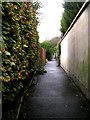
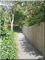
9
Central Path in St Paul's Churchyard, Birkenshaw
Doesn't it look much better now compared to this? Image
Image: © Stephen Armstrong
Taken: 4 Jul 2017
0.04 miles