
IMAGES TAKEN NEAR TO
Arthur Street, NELSON, BB9 9TP
Introduction
This page details the photographs taken nearby to Arthur Street, BB9 9TP by members of the Geograph project.
The Geograph project started in 2005 with the aim of publishing, organising and preserving representative images for every square kilometre of Great Britain, Ireland and the Isle of Man.

There are currently over 7.5m images from over14,400 individuals and you can help contribute to the project by visiting https://www.geograph.org.uk
Image Map
Images are licensed for reuse under creativecommons.org/licenses/by-sa/2.0
Notes
- Clicking on the map will re-center to the selected point.
- The higher the marker number, the further away the image location is from the centre of the postcode.
Image Listing (118 Images Found)
Images are licensed for reuse under creativecommons.org/licenses/by-sa/2.0
Image
Details
Distance
1
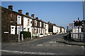
Chapel Street, Nelson, Lancashire
Chapel Street is a long street which runs parallel to the railway, and crosses Barkerhouse Road at about its mid-point, from where this photograph is taken, looking north-eastwards. The houses are numbers 94 and upwards, evens (to 144 at the far end).
Image: © Dr Neil Clifton
Taken: 19 Mar 2009
0.04 miles
2
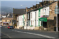
Barkerhouse Road, Nelson, Lancashire
Looking south-west. The shop is No 25 and the other houses, 23 to 1 (odds). In the far distance is seen Pendle Hill, home of the famous witches, which gave its name to the new Borough in 1974.
Image: © Dr Neil Clifton
Taken: 19 Mar 2009
0.05 miles
3
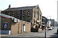
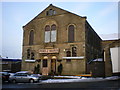
Former church, Barkerhouse Road, Nelson
This was formerly an Independent Methodist church. Now in commercial use. Taken from the junction of Barkerhouse Road with Leeds Road
Image: © Dr Neil Clifton
Taken: 19 Mar 2009
0.05 miles
7
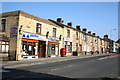
Leeds Road, Nelson, Lancashire
This is part of the A56 and used to be on the main route from East Lancashire to Airedale, until the opening of the parallel M65 some 25 years ago. The road is, however, still busy with local traffic.
Image: © Dr Neil Clifton
Taken: 19 Mar 2009
0.06 miles
8
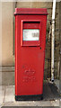
Elizabeth II postbox on Leeds Road, Nelson
Postbox No. BB9 110.
See Image] for context.
Image: © JThomas
Taken: 2 Aug 2018
0.07 miles
10
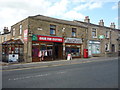
Clothes shop on Leeds Road, Nelson
Showing position of Postbox No. BB9 110.
See Image] for postbox.
Image: © JThomas
Taken: 2 Aug 2018
0.08 miles