
IMAGES TAKEN NEAR TO
Carleton Street, NELSON, BB9 9PH
Introduction
This page details the photographs taken nearby to Carleton Street, BB9 9PH by members of the Geograph project.
The Geograph project started in 2005 with the aim of publishing, organising and preserving representative images for every square kilometre of Great Britain, Ireland and the Isle of Man.

There are currently over 7.5m images from over14,400 individuals and you can help contribute to the project by visiting https://www.geograph.org.uk
Image Map
Images are licensed for reuse under creativecommons.org/licenses/by-sa/2.0
Notes
- Clicking on the map will re-center to the selected point.
- The higher the marker number, the further away the image location is from the centre of the postcode.
Image Listing (34 Images Found)
Images are licensed for reuse under creativecommons.org/licenses/by-sa/2.0
Image
Details
Distance
1

Benchmark on wall corner fronting #154 Chapel House Rd at Percy St junction
Some weeds (dandelion and sowthistle) below the Ordnance Survey benchmark which was levelled at 183.036m above Newlyn Datum in 1961
Image: © Roger Templeman
Taken: 14 Apr 2025
0.06 miles
2

Houses on Chapel House Road at Percy Street junction
There is an Ordnance Survey benchmark Image on the wall corner in front of the nearest house
Image: © Roger Templeman
Taken: 14 Apr 2025
0.06 miles
3
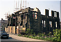
Former Congregationalist church, Nelson
At the junction of Brunswick Street and Chapel House Road. I had this labelled as a former Methodist church, but this was incorrect.
Image: © Dr Neil Clifton
Taken: 29 May 1992
0.12 miles
4

Benchmark on road end of party wall between #76 and #74 Chapel House Road
Ordnance Survey cut mark benchmark levelled at 161.078m above Newlyn Datum in 1961
Image: © Roger Templeman
Taken: 14 Apr 2025
0.12 miles
5
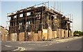
Former Congregationalist church, Nelson, Lancashire
This Victorian church which stood on the East corner at the intersection of Brunswick Street with Chapel House Road, is now but a memory. It is seen under demolition in the last week of May 1992.
Image: © Dr Neil Clifton
Taken: 29 May 1992
0.12 miles
6

Houses of Chapel House Road at Brunswick Street junction
There is an Ordnance Survey benchmark Image at the road end of the party wall between the two left hand houses, next to a metal gate
Image: © Roger Templeman
Taken: 14 Apr 2025
0.12 miles
7

Houses on Chapel House Road at Langholme Street junction
There is an Ordnance Survey benchmark Image on the corner of the wall fronting the nearest house
Image: © Roger Templeman
Taken: 14 Apr 2025
0.17 miles
8

Benchmark on corner of wall fronting #229 Chapel House Road
Ordnance Survey cut mark benchmark levelled at 194.590m in 1961
Image: © Roger Templeman
Taken: 14 Apr 2025
0.18 miles
9
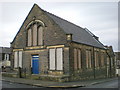
Former Baptist Chapel
Now used as a Masonic Hall
Image: © Alexander P Kapp
Taken: 15 Jan 2009
0.20 miles
10
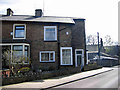
Vicarage Road
Vicarage Road close to St Pauls church Little Marsden Nelson.
Image: © Meg Metcalfe
Taken: Unknown
0.21 miles