
IMAGES TAKEN NEAR TO
Perth Street, NELSON, BB9 8EE
Introduction
This page details the photographs taken nearby to Perth Street, BB9 8EE by members of the Geograph project.
The Geograph project started in 2005 with the aim of publishing, organising and preserving representative images for every square kilometre of Great Britain, Ireland and the Isle of Man.

There are currently over 7.5m images from over14,400 individuals and you can help contribute to the project by visiting https://www.geograph.org.uk
Image Map
Images are licensed for reuse under creativecommons.org/licenses/by-sa/2.0
Notes
- Clicking on the map will re-center to the selected point.
- The higher the marker number, the further away the image location is from the centre of the postcode.
Image Listing (51 Images Found)
Images are licensed for reuse under creativecommons.org/licenses/by-sa/2.0
Image
Details
Distance
1

Benchmark on railway bridge buttress on SW side of Hildrop Road
Ordnance Survey cut mark benchmark levelled at 142.747m above Newlyn Datum verified 1961
Image: © Roger Templeman
Taken: 4 Apr 2025
0.03 miles
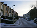
3

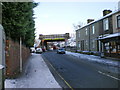
Railway Bridge GJC/95 Hildrop Road
There is an Ordnance Survey benchmark Image on the wall pier at the junction of the bridge buttress and the stone wall on the right hand side of the road (Hildrop Road)
Image: © Roger Templeman
Taken: 4 Apr 2025
0.05 miles
5
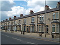
Leeds Road Nelson
Properties on Leeds Road Nelson renovated under the Housing Market Renewal scheme.
Image: © Richard Dwyer
Taken: 11 May 2010
0.06 miles
6

St Philip's Church on SE side of A56
The tower centre is an Ordnance Survey triangulation station, https://trigpointing.uk/trig/14651
Image: © Roger Templeman
Taken: 4 Apr 2025
0.08 miles
7
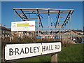
Bradley Youth Hub, Leeds Road, Nelson
Construction of a new Youth Centre on Leeds Road in Nelson, Lancashire.
Image: © Richard Dwyer
Taken: 12 Oct 2010
0.08 miles
8

Benchmark on the tower of St Philip's Church
Ordnance Survey cut mark benchmark levelled at 142.156m above Newlyn Datum verified 1961
Image: © Roger Templeman
Taken: 9 Apr 2025
0.09 miles
9
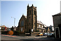
St. Philip's Church, Leeds Road, Nelson, Lancashire
This building is probably not in use for services, as signs outside proclaim it to be the Grass Roots Family Centre.
Image: © Dr Neil Clifton
Taken: 19 Mar 2009
0.09 miles
10
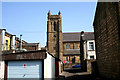
St. Philip's Church, Nelson
Seen from Harvey Street looking through a back entry passage.
Image: © Dr Neil Clifton
Taken: 19 Mar 2009
0.09 miles