IMAGES TAKEN NEAR TO
Swaine Street, NELSON, BB9 7AW
Introduction
This page details the photographs taken nearby to Swaine Street, BB9 7AW by members of the Geograph project.
The Geograph project started in 2005 with the aim of publishing, organising and preserving representative images for every square kilometre of Great Britain, Ireland and the Isle of Man.

There are currently over 7.5m images from over14,400 individuals and you can help contribute to the project by visiting https://www.geograph.org.uk
Image Map
Images are licensed for reuse under creativecommons.org/licenses/by-sa/2.0
Notes
- Clicking on the map will re-center to the selected point.
- The higher the marker number, the further away the image location is from the centre of the postcode.
Image Listing (162 Images Found)
Images are licensed for reuse under creativecommons.org/licenses/by-sa/2.0
Image
Details
Distance
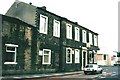
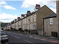
2
Whitefield
urban renewal in Whitefield
Image: © Charles Rawding
Taken: 19 Apr 2005
0.05 miles
3
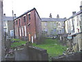
Whitefield
urban dereliction in Whitefield
Image: © Charles Rawding
Taken: 19 Apr 2005
0.05 miles
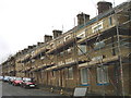
5
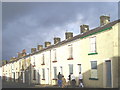
Whitefield
a terraced row ready for demolition - the photo was taken at Ede - hence the traditional dress
Image: © Charles Rawding
Taken: 21 Jan 2005
0.05 miles
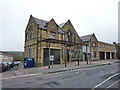
7
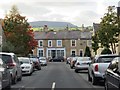
Nelson - Manchester Road - The Star Cycling Club
Image: © Alan Longbottom
Taken: 13 Aug 2007
0.05 miles
8
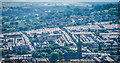
Little Marsden
View of Little Marsden seen from Dimpenly Top. The spire of St Mary's Church is visible (Image]).
Image: © Peter McDermott
Taken: 12 Jul 2014
0.05 miles
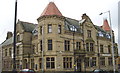
10
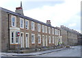
Building on the corner of Hargreaves Street and Every Street
Image: © Alexander P Kapp
Taken: 31 Mar 2010
0.06 miles