
IMAGES TAKEN NEAR TO
Churchill Way, NELSON, BB9 6RT
Introduction
This page details the photographs taken nearby to Churchill Way, BB9 6RT by members of the Geograph project.
The Geograph project started in 2005 with the aim of publishing, organising and preserving representative images for every square kilometre of Great Britain, Ireland and the Isle of Man.

There are currently over 7.5m images from over14,400 individuals and you can help contribute to the project by visiting https://www.geograph.org.uk
Image Map
Images are licensed for reuse under creativecommons.org/licenses/by-sa/2.0
Notes
- Clicking on the map will re-center to the selected point.
- The higher the marker number, the further away the image location is from the centre of the postcode.
Image Listing (11 Images Found)
Images are licensed for reuse under creativecommons.org/licenses/by-sa/2.0
Image
Details
Distance
1
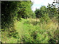
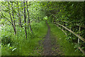
Path beside Pendle Water
Following a footpath sandwiched between an industrial estate and Pendle Water at Lomeshaye - vegetation screening much of the features from view.
Image: © Chris Heaton
Taken: 9 Oct 2012
0.05 miles
3
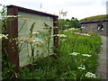
Lomeshaye Marsh Nature Reserve
Lomeshaye Marsh Nature Reserve Study Centre / Hide, Nelson, Lancashire
Image: © Richard Dwyer
Taken: 30 Jul 2010
0.11 miles
6
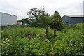
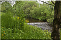
Path into Lomeshaye Industrial Estate
The path is just about discernible, and at least there is a bridge over the brook.
Image: © Bill Boaden
Taken: 4 Jun 2011
0.19 miles
7
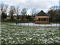
Bandstand, Victoria Park, Nelson
Too many Victorian bandstands have suffered from neglect or damage and in many cases have been removed for scrap iron. Happily this one in Nelson is well looked after and still in use. A stout fence protects against casual vandalism.
The houses in the background are at the junction of Park Avenue and Carr Hall Road.
Image: © Dr Neil Clifton
Taken: 9 Dec 2008
0.20 miles
9
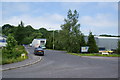
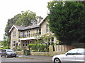
Pendleside
A side road in Lomeshaye Industrial Estate.
Image: © Bill Boaden
Taken: 4 Jun 2011
0.23 miles
10
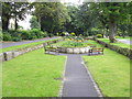
Sunken Garden, Victoria Park, Nelson, Lancashire
Image: © Robert Wade
Taken: 23 Aug 2011
0.23 miles