
IMAGES TAKEN NEAR TO
Kent Court, NELSON, BB9 6JS
Introduction
This page details the photographs taken nearby to Kent Court, BB9 6JS by members of the Geograph project.
The Geograph project started in 2005 with the aim of publishing, organising and preserving representative images for every square kilometre of Great Britain, Ireland and the Isle of Man.

There are currently over 7.5m images from over14,400 individuals and you can help contribute to the project by visiting https://www.geograph.org.uk
Image Map
Images are licensed for reuse under creativecommons.org/licenses/by-sa/2.0
Notes
- Clicking on the map will re-center to the selected point.
- The higher the marker number, the further away the image location is from the centre of the postcode.
Image Listing (61 Images Found)
Images are licensed for reuse under creativecommons.org/licenses/by-sa/2.0
Image
Details
Distance
1
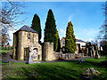
Original site of St Thomas, Barrowford
The church was founded in 1839, and the image was taken in the grounds looking towards the back of the original building, a new premises has been erected nearby and on the opposite side of the road.
Image: © Steve Houldsworth
Taken: 23 Sep 2011
0.09 miles
2

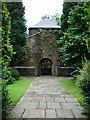
Benchmark on tower of the ruined St Thomas's Church
Ordnance Survey 1GL bolt benchmark levelled at 136.226m above Newlyn Datum in 1956 and verified 1961
Image: © Roger Templeman
Taken: 9 Apr 2025
0.09 miles
7
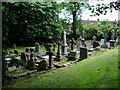
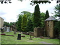
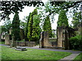
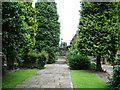
Graveyard, St Thomas Church, Barrowford
Image: © Alexander P Kapp
Taken: 23 Jul 2007
0.11 miles
8
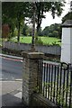
Lancashire Fingerpost
Now missing all of its fingers.
Image: © Andrew Riley
Taken: 9 Sep 2018
0.11 miles
9
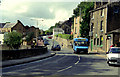
Road junction in Barrowford, Lancashire
This shows the junction of Gisburn Road (main road, part of the A682) with Church Street (in the centre). The latter road gives access to the Pendleside villages such as Fence, Wheatley Lane and Higham, while the A682 gives a route from the A56 in Barrowford to the A59 at Gisburn. The blue minibus displays route number 66, destination: Blacko, a village about two miles away up the A682.
Image: © Dr Neil Clifton
Taken: 12 Aug 1992
0.13 miles
10
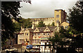
Barrowford, Lancashire
Let Granny mind the kids while they play in the park or paddle in Pendle Water, while you nip across the road for a swift half in the 'White Bear'
Image: © Dr Neil Clifton
Taken: 12 Aug 1992
0.13 miles