
IMAGES TAKEN NEAR TO
Sackville Street, NELSON, BB9 0JG
Introduction
This page details the photographs taken nearby to Sackville Street, BB9 0JG by members of the Geograph project.
The Geograph project started in 2005 with the aim of publishing, organising and preserving representative images for every square kilometre of Great Britain, Ireland and the Isle of Man.

There are currently over 7.5m images from over14,400 individuals and you can help contribute to the project by visiting https://www.geograph.org.uk
Image Map
Images are licensed for reuse under creativecommons.org/licenses/by-sa/2.0
Notes
- Clicking on the map will re-center to the selected point.
- The higher the marker number, the further away the image location is from the centre of the postcode.
Image Listing (11 Images Found)
Images are licensed for reuse under creativecommons.org/licenses/by-sa/2.0
Image
Details
Distance
1

Benchmark on Pilgrim Street face of #202 Brunswick Street
Ordnance Survey cut mark benchmark levelled at 168.454m above Newlyn Datum in 1961, with geranium leaves at pavement level
Image: © Roger Templeman
Taken: 14 Apr 2025
0.05 miles
2
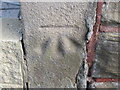
Ordnance Survey Cut Mark
This mark can be found on the wall of 202 Brunswick Street.
For more detail see : http://www.bench-marks.org.uk/bm45265
Image: © Peter Wood
Taken: 5 Sep 2012
0.05 miles
3

Brunswick Street houses seen from Pilgrim Street
There is an Ordnance Survey benchmark Image on the left hand corner of the house at the middle of the image.
Image: © Roger Templeman
Taken: 14 Apr 2025
0.06 miles
4

Looking along Railway Street from opposite Waldshouse Road junction
There is an Ordnance Survey benchmark Image on a stone in the wall (3rd up from pavement and 4th from left edge of image)
Image: © Roger Templeman
Taken: 14 Apr 2025
0.07 miles
5
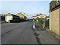
Brunswick Street, Nelson
Thoroughfare running towards Nelson town centre, slightly above the Walverden Valley.
Image: © Chris Heaton
Taken: 30 Nov 2011
0.08 miles
6

Benchmark, mason's mark and geum on wall on NE side of Railway Street
The Ordnance Survey cut mark benchmark was levelled at 165.442m above Newlyn Datum in 1961
Image: © Roger Templeman
Taken: 14 Apr 2025
0.14 miles
7
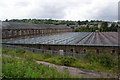
Mill roof in Nelson
One of many mills still occupying the Walverden valley.
Image: © Bill Boaden
Taken: 16 Jun 2011
0.15 miles
8
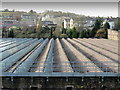
Looking over the Roof of Valley Mills
This large mill fills the bottom of the Walverden Valley, with views towards Little Marsden beyond.
Image: © Chris Heaton
Taken: 30 Nov 2011
0.16 miles
9
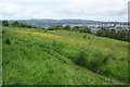
Quarry Hill
An open hillside in Nelson which has been retained as a local nature reserve.
Image: © Bill Boaden
Taken: 16 Jun 2011
0.18 miles
10
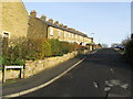
Messenger Street, Nelson
Road offering terraced housing off Southfield Street, opposite the Valley Mills.
Image: © Chris Heaton
Taken: 30 Nov 2011
0.22 miles