IMAGES TAKEN NEAR TO
Peel Road, COLNE, BB8 9NX
Introduction
This page details the photographs taken nearby to Peel Road, BB8 9NX by members of the Geograph project.
The Geograph project started in 2005 with the aim of publishing, organising and preserving representative images for every square kilometre of Great Britain, Ireland and the Isle of Man.

There are currently over 7.5m images from over14,400 individuals and you can help contribute to the project by visiting https://www.geograph.org.uk
Image Map
Images are licensed for reuse under creativecommons.org/licenses/by-sa/2.0
Notes
- Clicking on the map will re-center to the selected point.
- The higher the marker number, the further away the image location is from the centre of the postcode.
Image Listing (167 Images Found)
Images are licensed for reuse under creativecommons.org/licenses/by-sa/2.0
Image
Details
Distance
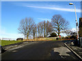
1
Colne: Cross Street West
This is looking east from the top of Bankfield Street. Old housing on this street has all been replaced by post-WWII dwellings.
Image: © Dr Neil Clifton
Taken: 11 Feb 2010
0.03 miles
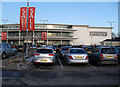
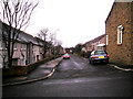
2
Colne: Cross Street West
Looking west from its junction with Leach Street
Image: © Dr Neil Clifton
Taken: 9 Feb 2010
0.04 miles
3
Colne: Trees at the top of Bankfield Street
Mostly a mixture of sycamore and birch. There was a sand quarry here in former years.
Image: © Dr Neil Clifton
Taken: 11 Feb 2010
0.05 miles
4
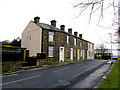
Colne: 19-29 Leach Street
At the northern end of Leach Street. There is no outlet for vehicular traffic at this end of the street.
Image: © Dr Neil Clifton
Taken: 9 Feb 2010
0.05 miles
5
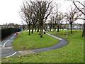
Colne: Footpaths and cycleway
Access for pedestrians and cyclists from the north end of Leach Street
Image: © Dr Neil Clifton
Taken: 9 Feb 2010
0.05 miles
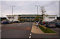
6
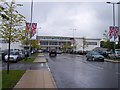
Boundary Mill retail outlet at Colne
Image: © Raymond Knapman
Taken: 16 May 2011
0.06 miles
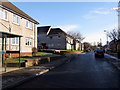
7
Colne: Bolton Street
This street of mostly post-WWII housing, runs west from the bottom of Leach Street.
Image: © Dr Neil Clifton
Taken: 9 Feb 2010
0.06 miles
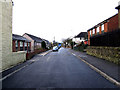
8
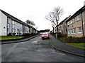
Colne: Peel Road
Peel Road runs westward from near the top of Leach Street. At its far (western) end, it bends round to join Cross Street West. This part of Colne is called Bunkers Hill. Inevitably, local wags substitute an 'o' for a 'u' in its name.
Image: © Dr Neil Clifton
Taken: 9 Feb 2010
0.06 miles