IMAGES TAKEN NEAR TO
Rye Croft, COLNE, BB8 8TH
Introduction
This page details the photographs taken nearby to Rye Croft, BB8 8TH by members of the Geograph project.
The Geograph project started in 2005 with the aim of publishing, organising and preserving representative images for every square kilometre of Great Britain, Ireland and the Isle of Man.

There are currently over 7.5m images from over14,400 individuals and you can help contribute to the project by visiting https://www.geograph.org.uk
Image Map
Images are licensed for reuse under creativecommons.org/licenses/by-sa/2.0
Notes
- Clicking on the map will re-center to the selected point.
- The higher the marker number, the further away the image location is from the centre of the postcode.
Image Listing (20 Images Found)
Images are licensed for reuse under creativecommons.org/licenses/by-sa/2.0
Image
Details
Distance
1
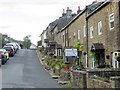
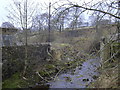
New Development Hollin Hall
Old mill site
Image: © Robert Wade
Taken: 23 Jun 2007
0.01 miles
5
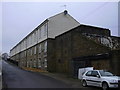
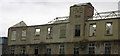
Hollins Mill AD1855, Trawden, Lancashire
Being converted into apartments
Image: © Robert Wade
Taken: 7 Feb 2010
0.02 miles
6
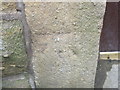
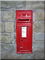
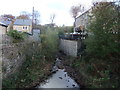
Ordnance Survey Cut Mark
This mark can be found on the door post of a house at Hollin Hall.
For more detail see : http://www.bench-marks.org.uk/bm43616
Image: © Peter Wood
Taken: 23 Jun 2012
0.03 miles
7
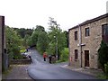
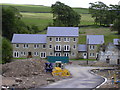
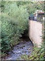
Hollin Hall Barn
The bridge over Trawden Brook in middle distance
Image: © Raymond Knapman
Taken: 9 Aug 2010
0.03 miles