1
Colne: Burnley Road, looking west
This is part of the A56, and is always busy, being the main road to Nelson and Burnley. The street on the right where the small green van is parked, is Ridehalgh Street.
Image: © Dr Neil Clifton
Taken: 19 Mar 2010
0.01 miles
2
Colne: House backs, Burnley Road
On the west side of Burnley Road and looking towards Phillips Lane.
Image: © Dr Neil Clifton
Taken: 17 Mar 2010
0.01 miles
3
Holy Trinity Church, Burnley Road, Colne, Lancashire BB8 8JA
Image: © Robert Wade
Taken: 28 Oct 2009
0.02 miles
4
Colne: Holy Trinity Church
On the south side of Burnley Road. This is still an open and active church, although some of the end windows have been tinned-up, presumably as protection against vandals. The road joining at this point is Dent Street.
Image: © Dr Neil Clifton
Taken: 11 Feb 2010
0.02 miles
5
Holy Trinity Church on Burnley Road
Image: © Steve Daniels
Taken: 17 Sep 2013
0.02 miles
6
Holy Trinity, Colne C of E
Located opposite the junction with Phillips Lane on Burnley Rd Colne the church was founded in 1909, the building was still in use when this image was taken.
Image: © Steve Houldsworth
Taken: 27 Feb 2011
0.03 miles
7
Colne: Phillips Lane
Looking north from Burnley Road. The large building is the old electricity works. At the bottom of the hill, the bridge is Greenfield Bridge, which crosses Colne Water.
Image: © Dr Neil Clifton
Taken: 17 Mar 2010
0.03 miles
8
Colne: Greenfield Bridge
Looking upstream on Colne Water, we see the bridge which carries Phillips Lane across.
Image: © Dr Neil Clifton
Taken: 11 Feb 2010
0.03 miles
9
Colne: Confluence of Bunkers Hill Brook with Colne Water
This shows the point at which Bunkers Hill Brook flows into Colne Water, just above Greenfield Bridge. The bridge itself is seen to the left, and Colne Water is also crossed here by an enclosed metal aqueduct, whose purpose I do not know. The old electricity works is seen behind, to the left.
Image: © Dr Neil Clifton
Taken: 11 Feb 2010
0.03 miles
10
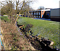
Colne: Bunkers Hill Brook
Near the junction of Greenfield Road with Phillips Lane, a small brook is culverted under the road, whence it runs down parallel to the east side of Phillips Lane, to join Colne Water just above Greenfield Bridge. Since this brook is not named on any of the maps to which I have access, I have decided to name it Bunkers Hill Brook, as higher up it used to feed the small and long-demolished Bunkers Hill Mill. In this photograph, Bunkers Hill Brook is seen as it flows down adjacent to Phillips Lane.
Image: © Dr Neil Clifton
Taken: 11 Feb 2010
0.03 miles


