1
Colne: Phillips Lane
Looking north down Phillips Lane from its junction with Burnley Road, Greenfield Bridge (over Colne Water) is seen at the bottom of the hill. Beyond there, on the left, are the old electricity works, and Phillips Lane then rises to meet Greenfield Road at the far end.
Image: © Dr Neil Clifton
Taken: 11 Feb 2010
0.03 miles
2
Colne: House backs, Burnley Road
On the west side of Burnley Road and looking towards Phillips Lane.
Image: © Dr Neil Clifton
Taken: 17 Mar 2010
0.05 miles
3
Colne: Burnley Road, looking west
This is part of the A56, and is always busy, being the main road to Nelson and Burnley. The street on the right where the small green van is parked, is Ridehalgh Street.
Image: © Dr Neil Clifton
Taken: 19 Mar 2010
0.05 miles
4
Colne: Phillips Lane
Looking north from Burnley Road. The large building is the old electricity works. At the bottom of the hill, the bridge is Greenfield Bridge, which crosses Colne Water.
Image: © Dr Neil Clifton
Taken: 17 Mar 2010
0.05 miles
5
Colne: Greenfield Bridge
Looking upstream on Colne Water, we see the bridge which carries Phillips Lane across.
Image: © Dr Neil Clifton
Taken: 11 Feb 2010
0.05 miles
6
Colne: Confluence of Bunkers Hill Brook with Colne Water
This shows the point at which Bunkers Hill Brook flows into Colne Water, just above Greenfield Bridge. The bridge itself is seen to the left, and Colne Water is also crossed here by an enclosed metal aqueduct, whose purpose I do not know. The old electricity works is seen behind, to the left.
Image: © Dr Neil Clifton
Taken: 11 Feb 2010
0.05 miles
7
Colne: Bunkers Hill Brook
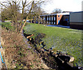
Near the junction of Greenfield Road with Phillips Lane, a small brook is culverted under the road, whence it runs down parallel to the east side of Phillips Lane, to join Colne Water just above Greenfield Bridge. Since this brook is not named on any of the maps to which I have access, I have decided to name it Bunkers Hill Brook, as higher up it used to feed the small and long-demolished Bunkers Hill Mill. In this photograph, Bunkers Hill Brook is seen as it flows down adjacent to Phillips Lane.
Image: © Dr Neil Clifton
Taken: 11 Feb 2010
0.05 miles
8
Phillips Street
Many of the houses in this area are built on the side of hills like here in Phillips Street.
In fact the steepness of this hill does not come across very well in the photograph.
Image: © Paul Anderson
Taken: 27 Jan 2007
0.05 miles
9
Colne: Bunkers Hill Brook
Looking downstream to its confluence with Colne Water just above Greenfield Bridge.
Image: © Dr Neil Clifton
Taken: 17 Mar 2010
0.05 miles
10
Holy Trinity Church, Burnley Road, Colne, Lancashire BB8 8JA
Image: © Robert Wade
Taken: 28 Oct 2009
0.06 miles


