IMAGES TAKEN NEAR TO
Robinson Street, COLNE, BB8 7LG
Introduction
This page details the photographs taken nearby to Robinson Street, BB8 7LG by members of the Geograph project.
The Geograph project started in 2005 with the aim of publishing, organising and preserving representative images for every square kilometre of Great Britain, Ireland and the Isle of Man.

There are currently over 7.5m images from over14,400 individuals and you can help contribute to the project by visiting https://www.geograph.org.uk
Image Map
Images are licensed for reuse under creativecommons.org/licenses/by-sa/2.0
Notes
- Clicking on the map will re-center to the selected point.
- The higher the marker number, the further away the image location is from the centre of the postcode.
Image Listing (189 Images Found)
Images are licensed for reuse under creativecommons.org/licenses/by-sa/2.0
Image
Details
Distance
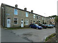
2
View over Foulridge
A short ascent from the shore of Foulridge Lower Reservoir brings one to this viewpoint which looks north over part of the village and towards the promised land of Yorkshire, with the snow rimmed Great Whernside visible in the distance.
Image: © Gordon Hatton
Taken: 5 Apr 2018
0.02 miles
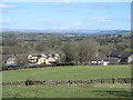
3
Foulridge, Lancashire: Mile End Close
These new houses have open country on the north and west sides. The name 'Mile End' derives from the nearby Foulridge Tunnel on the Leeds and Liverpool Canal, locally known as the 'Mile Tunnel'
Image: © Dr Neil Clifton
Taken: 12 Apr 2010
0.02 miles
5
Foulridge station, Lancashire
When the ex-Midland Railway line from Skipton to Colne closed in the early 1970s (a consequence of the Beeching plan) the stations were abandoned, but this one was later taken down by the Keighley and Worth Valley Railway and erected at Ingrow West where it survives today.
Image: © Dr Neil Clifton
Taken: 23 Apr 1983
0.04 miles
7
Foulridge Tunnel on the Leeds & Liverpool Canal
Image: © Ian S
Taken: 9 Oct 2010
0.04 miles
8
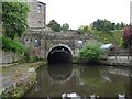
Eastern portal, Foulridge Tunnel
Green to go, even though only one light is working. Boats are currently allowed in the eastern end between xx.00 and xx.10, and in the western end between xx.30 and xx.40.
Image: © Christine Johnstone
Taken: 7 Jun 2017
0.04 miles
9
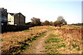
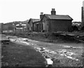
Foulridge, Lancashire: Track of former railway
This shows the trackbed of the former Midland Railway route southwards from Foulridge towards Colne, where it met the Lancashire & Yorkshire railway end-on in Colne station. Reinstatement of this line between Colne and Skipton is the subject of a vigorous campaign by SELRAP, strongly supported by local MP Gordon Prentice.
Image: © Dr Neil Clifton
Taken: 12 Apr 2010
0.04 miles
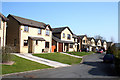
10
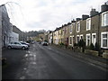
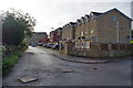
Station Road, Foulridge
There used to be a railway station at the end of this road - hence the name.
Image: © Chris Heaton
Taken: 11 Feb 2009
0.05 miles