
IMAGES TAKEN NEAR TO
Lambeth Street, COLNE, BB8 7BL
Introduction
This page details the photographs taken nearby to Lambeth Street, BB8 7BL by members of the Geograph project.
The Geograph project started in 2005 with the aim of publishing, organising and preserving representative images for every square kilometre of Great Britain, Ireland and the Isle of Man.

There are currently over 7.5m images from over14,400 individuals and you can help contribute to the project by visiting https://www.geograph.org.uk
Image Map
Images are licensed for reuse under creativecommons.org/licenses/by-sa/2.0
Notes
- Clicking on the map will re-center to the selected point.
- The higher the marker number, the further away the image location is from the centre of the postcode.
Image Listing (41 Images Found)
Images are licensed for reuse under creativecommons.org/licenses/by-sa/2.0
Image
Details
Distance
1

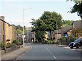
Lambeth Street, Cotton Tree
Street in Cotton Tree, near Colne.
Image: © Chris Heaton
Taken: 11 Feb 2009
0.02 miles
2

Benchmark on buttress of Methodist Church, Cotton Tree Lane
Ordnance Survey cut mark benchmark levelled at 155.262m above Newlyn Datum verified 1961
Image: © Roger Templeman
Taken: 6 May 2025
0.03 miles
3

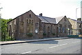
Methodist Church on south side of Cotton Tree Lane
There is an Ordnance Survey benchmark Image on the buttress left of centre of the image, below pebbledash
Image: © Roger Templeman
Taken: 6 May 2025
0.04 miles
4
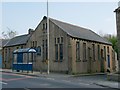
Cotton Tree Methodist Colne
At the time this image was taken the building was in use by Cotton Tree Methodists, the stone on the building states Wesleyan School Chapel so it may originally have had other occupants.
Image: © Steve Houldsworth
Taken: 21 Apr 2011
0.04 miles
8

Western parapet of bridge taking Trawden Road over Colne Water
The carved TRAWDEN COLNE on the parapet top indicates that the boundary between the two parishes is along the middle of the river
Image: © Roger Templeman
Taken: 6 May 2025
0.12 miles
9

Benchmark on wall on northeast side of Cotton Tree Lane
Ordnance Survey cut mark benchmark levelled at 156.466m above Newlyn Datum verified 1961
Image: © Roger Templeman
Taken: 6 May 2025
0.12 miles
10
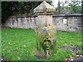
Grotesque old gatepost in Colne
This gatepost, with its strange carved face, is at the end of Standroyd Road, Colne. The footpath following the track-bed of the former tramway to Trawden begins just past here. I can find no trace of a second gatepost.
Image: © Derek Haslam
Taken: 27 Feb 2014
0.12 miles