IMAGES TAKEN NEAR TO
Nightingale Close, CLITHEROE, BB7 9XB
Introduction
This page details the photographs taken nearby to Nightingale Close, BB7 9XB by members of the Geograph project.
The Geograph project started in 2005 with the aim of publishing, organising and preserving representative images for every square kilometre of Great Britain, Ireland and the Isle of Man.

There are currently over 7.5m images from over14,400 individuals and you can help contribute to the project by visiting https://www.geograph.org.uk
Image Map (19 Images)


Getting Data...Please wait
Leaflet Map data © OpenStreetMap
Images are licensed for reuse under creativecommons.org/licenses/by-sa/2.0
Notes
- Clicking on the map will re-center to the selected point.
- The higher the marker number, the further away the image location is from the centre of the postcode.
Image Listing (19 Images Found)
Images are licensed for reuse under creativecommons.org/licenses/by-sa/2.0
Image
Details
Distance
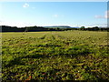
1
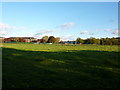
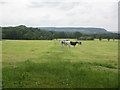
Pasture west side of Calderstones Hospital
Image: © Alexander P Kapp
Taken: 24 Oct 2010
0.08 miles
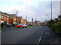
2
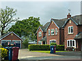
The end of Westfield Close allows no access to the footpath
Image: © Ian Greig
Taken: 23 May 2014
0.09 miles
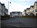
8
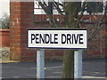
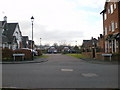
The name lives on
When Calderstones Park was a hospital there were two main through fares, Calder Avenue and Pendle Drive, Pendle Drive has been kept and is now one of the main roads of the housing estate. Calder Avenue is still used but in the hospital complex.
Image: © Alexander P Kapp
Taken: 25 Dec 2008
0.16 miles
9
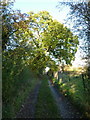
A not very often used track off Turkey Lane
Image: © Alexander P Kapp
Taken: 24 Oct 2010
0.16 miles