IMAGES TAKEN NEAR TO
Hayhurst Close, CLITHEROE, BB7 9SQ
Introduction
This page details the photographs taken nearby to Hayhurst Close, BB7 9SQ by members of the Geograph project.
The Geograph project started in 2005 with the aim of publishing, organising and preserving representative images for every square kilometre of Great Britain, Ireland and the Isle of Man.

There are currently over 7.5m images from over14,400 individuals and you can help contribute to the project by visiting https://www.geograph.org.uk
Image Map
Images are licensed for reuse under creativecommons.org/licenses/by-sa/2.0
Notes
- Clicking on the map will re-center to the selected point.
- The higher the marker number, the further away the image location is from the centre of the postcode.
Image Listing (39 Images Found)
Images are licensed for reuse under creativecommons.org/licenses/by-sa/2.0
Image
Details
Distance
1
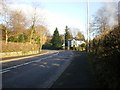
Clitheroe Road, Whalley
The road to the right just before the house is Wiswell Lane
Image: © Alexander P Kapp
Taken: 26 Dec 2008
0.04 miles
2
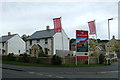
New housing development, Whalley
Off Clitheroe Road.
Image: © JThomas
Taken: 24 Sep 2016
0.06 miles
3
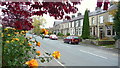
Halloween Roses
Pretty garden roses add colour and frame a photograph of solid terraced homes on Clitheroe Road, Whalley.
Image: © Steve Reeves
Taken: 31 Oct 2010
0.12 miles
4

Looking north along Clitheroe Road at Brooke's Lane junction
There is an Ordnance Survey benchmark Image at the base of the wall pier in the right foreground
Image: © Roger Templeman
Taken: 29 Jun 2024
0.13 miles
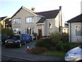
6
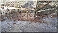
Benchmark on wall on east side of Clitheroe Road at Brooke's Lane junction
Ordnance Survey cut mark benchmark levelled at 50.960m above Newlyn Datum verified 1961
Image: © Roger Templeman
Taken: 29 Jun 2024
0.16 miles
7
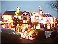
Who pays the bill?
Christmas lights in Limefield Avenue
Image: © Alexander P Kapp
Taken: 26 Dec 2006
0.16 miles
8
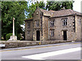
Whalley War Memorial and Royal Grammar School Building
At the corner of King Street and Station Road. Both are Grade II listed structures, the building is now used as an adult education centre.
Image: © David Dixon
Taken: 19 Jun 2010
0.17 miles
9
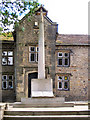
Whalley War Memorial
Whalley War Memorial is a Grade II listed structure. It is in the form of a tall, tapering cross shaft with a gabled head over a relief of Christ, standing on a heavy square base bearing the names of the WW1 fatalities from the village; in front is an open book with the WW2 and later fatalities. The memorial is set at the top of steps within a landscaped area in front of the Grade II-listed Royal Grammar School buildings (now used as an adult education centre).
Image: © David Dixon
Taken: 19 Jun 2010
0.17 miles