
IMAGES TAKEN NEAR TO
Terrace Row, CLITHEROE, BB7 9NX
Introduction
This page details the photographs taken nearby to Terrace Row, BB7 9NX by members of the Geograph project.
The Geograph project started in 2005 with the aim of publishing, organising and preserving representative images for every square kilometre of Great Britain, Ireland and the Isle of Man.

There are currently over 7.5m images from over14,400 individuals and you can help contribute to the project by visiting https://www.geograph.org.uk
Image Map
Images are licensed for reuse under creativecommons.org/licenses/by-sa/2.0
Notes
- Clicking on the map will re-center to the selected point.
- The higher the marker number, the further away the image location is from the centre of the postcode.
Image Listing (489 Images Found)
Images are licensed for reuse under creativecommons.org/licenses/by-sa/2.0
Image
Details
Distance
1
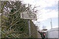
Old Village Signpost by the A59, Whalley Road, Billington
No finial - 1 arm; by the A59, in parish of Billington and Langho (Ribble Valley District), Billington.
Inscription reads:-
A59
BILLINGTON
To be surveyed
Milestone Society National ID: LA_SD7335
Image: © Milestone Society
Taken: Unknown
0.01 miles
2
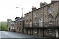
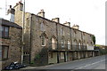
Terrace Row
A very interesting row of terraced houses with arched windows and doors
Image: © Graeme Smith
Taken: 22 May 2011
0.02 miles
3
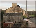
I wouldn't park there!
I would not want to risk driving a car into this old garage perched on a high, open brick wall.
Image: © Stephen Craven
Taken: 25 Nov 2015
0.02 miles
4
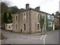
No 2 Whalley Road
This house on the corner of Moor Lane and Whalley Road use to be a shop, the conversion of the two windows, one front and the near side one have been changed to be in keeping with the rest of the building
Image: © Alexander P Kapp
Taken: 28 Mar 2009
0.02 miles
7
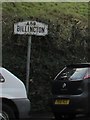
Roadsign on Whalley Road, Billington
Or Whalley New Road, as some maps call it. Formerly the A59 as recorded on this "pre-Worboys" sign, now unclassified. For context, see Image
Image: © Stephen Craven
Taken: 25 Nov 2015
0.03 miles
8
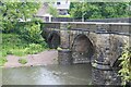
Whalley Bridge
Bridge over the River Calder, Whalley
Image: © Graeme Smith
Taken: 22 May 2011
0.03 miles

10
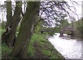
Whalley Road Bridge
Spanning the River Calder, at the south eastern end of the village.
Image: © philandju
Taken: 8 May 2012
0.03 miles