IMAGES TAKEN NEAR TO
Calder Place, CLITHEROE, BB7 9NH
Introduction
This page details the photographs taken nearby to Calder Place, BB7 9NH by members of the Geograph project.
The Geograph project started in 2005 with the aim of publishing, organising and preserving representative images for every square kilometre of Great Britain, Ireland and the Isle of Man.

There are currently over 7.5m images from over14,400 individuals and you can help contribute to the project by visiting https://www.geograph.org.uk
Image Map (Loading...)


Getting Data...Please wait
Leaflet Map data © OpenStreetMap
Images are licensed for reuse under creativecommons.org/licenses/by-sa/2.0
Notes
- Clicking on the map will re-center to the selected point.
- The higher the marker number, the further away the image location is from the centre of the postcode.
Image Listing (44 Images Found)
Images are licensed for reuse under creativecommons.org/licenses/by-sa/2.0
Image
Details
Distance
4
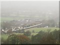
Freight train approaching Whalley Viaduct
A train of cement hoppers on a misty day: if the weather had been clearer this could have been a good photo, but by the time the train was on the viaduct (right) it was almost lost in the mist.
Image: © Stephen Craven
Taken: 26 Nov 2015
0.07 miles
5
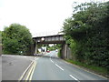
Railway bridge over Whalley Road, Billington
Image: © JThomas
Taken: 16 Jul 2016
0.07 miles
6
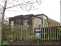
Neddy Lane substation, Billington
An older looking building than most electricity substations.
Image: © Stephen Craven
Taken: 26 Nov 2015
0.08 miles
7
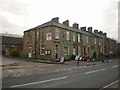
Billington Village Shop
The post office facility was closed in 2008
Image: © Alexander P Kapp
Taken: 24 Dec 2008
0.09 miles
8
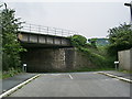
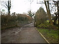
Railway bridge
Carries the Clitheroe to Manchester over what was the A59
Image: © Alexander P Kapp
Taken: 29 May 2008
0.09 miles
9
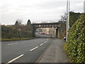
Whalley Road
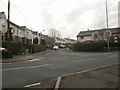
The railway bridge carries the Blackburn to Clitheroe railway
Image: © Alexander P Kapp
Taken: 24 Dec 2008
0.10 miles
10
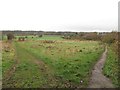
Footpaths beyond Neddy Lane
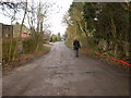
At the end of the road there is a choice of paths: to the right is a public footpath to the footbridge over the Calder, and to the left an unofficial path that is a shortcut to another public footpath to Hacking Hall.
Image: © Stephen Craven
Taken: 26 Nov 2015
0.10 miles